Approximate Location Map
Large Map »
Latitude: 51.2814 / 51°16'53"N
Longitude: 1.0851 / 1°5'6"E
OS Eastings: 615246
OS Northings: 158106
OS Grid: TR152581
Mapcode National: GBR TY2.R4H
Mapcode Global: VHLGM.R2H0
Plus Code: 9F3373JP+H2
Entry Name: 1, Albion Place
Listing Date: 7 September 1973
Grade: II
Source: Historic England
Source ID: 1248633
English Heritage Legacy ID: 170359
ID on this website: 101248633
Location: Northgate, Canterbury, Kent, CT1
County: Kent
District: Canterbury
Electoral Ward/Division: Northgate
Parish: Non Civil Parish
Built-Up Area: Canterbury
Traditional County: Kent
Lieutenancy Area (Ceremonial County): Kent
Tagged with: Building
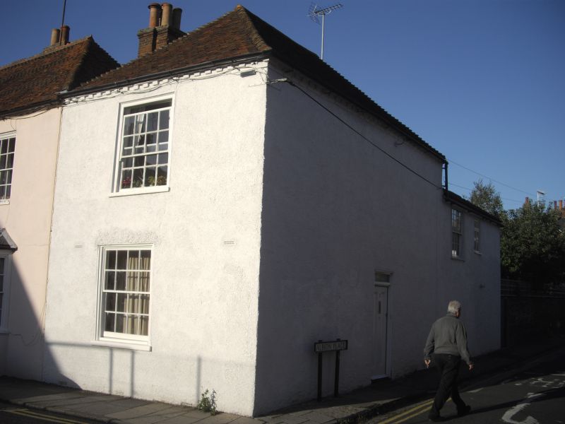
1.
944 ALBION PLACE
No 1
TR 1558 SW 3/406
II GV
2.
Late C18 to early C19. 2 storeys pebble dash. Hipped tiled roof. 1 sash
with glazing bars intact, Simple altered doorcase. Rear elevation has 1
sash. The elevation to Broad Street has 1 sash with verticals only.
Group value with Nos 47 to 52 (consec) Broad Street.
Listing NGR: TR1524658106
External links are from the relevant listing authority and, where applicable, Wikidata. Wikidata IDs may be related buildings as well as this specific building. If you want to add or update a link, you will need to do so by editing the Wikidata entry.


Other nearby listed buildings
