Approximate Location Map
Large Map »
Latitude: 51.1237 / 51°7'25"N
Longitude: -0.0068 / 0°0'24"W
OS Eastings: 539585
OS Northings: 137937
OS Grid: TQ395379
Mapcode National: GBR KLY.K2Q
Mapcode Global: VHGSZ.T0SW
Plus Code: 9C3X4XFV+F7
Entry Name: 34-40, High Street
Listing Date: 2 August 1972
Grade: II
Source: Historic England
Source ID: 1248819
English Heritage Legacy ID: 430561
ID on this website: 101248819
Location: East Grinstead, Mid Sussex, RH19
County: West Sussex
District: Mid Sussex
Civil Parish: East Grinstead
Built-Up Area: East Grinstead
Traditional County: Sussex
Lieutenancy Area (Ceremonial County): West Sussex
Church of England Parish: East Grinstead St Swithun
Church of England Diocese: Chichester
Tagged with: Building
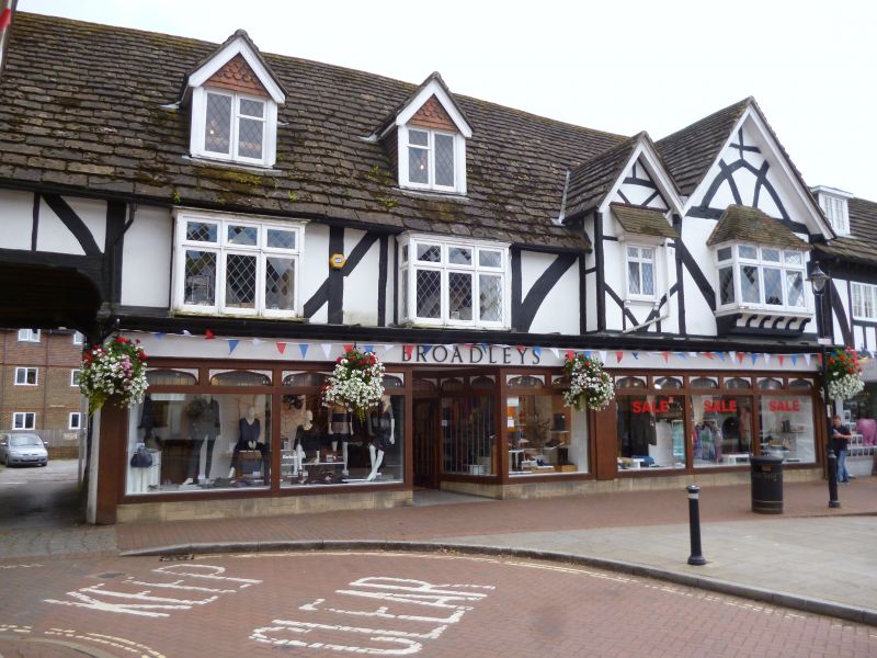
1.
1068 HIGH STREET
(South Side)
Nos 34 to 40 (even)
TQ 3937 1/31
II GV
2.
Originally 2 separate buildings 2 storey, now linked together by common modern
shop frontage. To right hand two gables (1 large, 1 small) some original
timber framing and plaster, but C19 fenestration.
Nos 34 to 50 (even) form a group.
Listing NGR: TQ3958337934
External links are from the relevant listing authority and, where applicable, Wikidata. Wikidata IDs may be related buildings as well as this specific building. If you want to add or update a link, you will need to do so by editing the Wikidata entry.


Other nearby listed buildings
