Approximate Location Map
Large Map »
Latitude: 51.124 / 51°7'26"N
Longitude: -0.006 / 0°0'21"W
OS Eastings: 539642
OS Northings: 137965
OS Grid: TQ396379
Mapcode National: GBR KLY.K96
Mapcode Global: VHGSZ.V06P
Plus Code: 9C3X4XFV+HJ
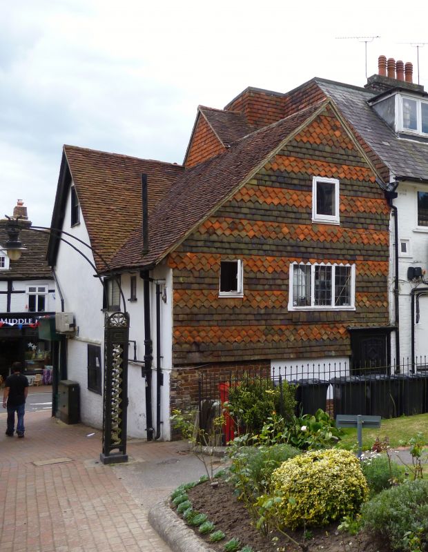
Entry Name: 49A, High Street
Listing Date: 2 August 1972
Grade: II
Source: Historic England
Source ID: 1248870
English Heritage Legacy ID: 430642
ID on this website: 101248870
Location: East Grinstead, Mid Sussex, RH19
County: West Sussex
District: Mid Sussex
Civil Parish: East Grinstead
Built-Up Area: East Grinstead
Traditional County: Sussex
Lieutenancy Area (Ceremonial County): West Sussex
Church of England Parish: East Grinstead St Swithun
Church of England Diocese: Chichester
Tagged with: Building
1.
1068 HIGH STREET
(North Side)
No 49A
TQ 3937 1/45
II
2.
Small timber frame building now plastered. 1 storey above shop. No 51 guards
the left hand of entrance to churchyard, as No 53 guards the right hand entrance.
Tile hung wing at rear with 1st floor casement window of 3 lights.
Listing NGR: TQ3964337969
External links are from the relevant listing authority and, where applicable, Wikidata. Wikidata IDs may be related buildings as well as this specific building. If you want to add or update a link, you will need to do so by editing the Wikidata entry.


Other nearby listed buildings
