Approximate Location Map
Large Map »
Latitude: 52.1618 / 52°9'42"N
Longitude: -0.6279 / 0°37'40"W
OS Eastings: 493951
OS Northings: 252393
OS Grid: SP939523
Mapcode National: GBR F07.J2G
Mapcode Global: VHFPZ.2XDM
Plus Code: 9C4X596C+PR
Entry Name: 78, Bridge Street
Listing Date: 27 August 1987
Grade: II
Source: Historic England
Source ID: 1249065
English Heritage Legacy ID: 430899
ID on this website: 101249065
Location: Turvey, Bedford, Bedfordshire, MK43
County: Bedford
Civil Parish: Turvey
Built-Up Area: Turvey
Traditional County: Bedfordshire
Lieutenancy Area (Ceremonial County): Bedfordshire
Church of England Parish: Turvey
Church of England Diocese: St.Albans
Tagged with: Building
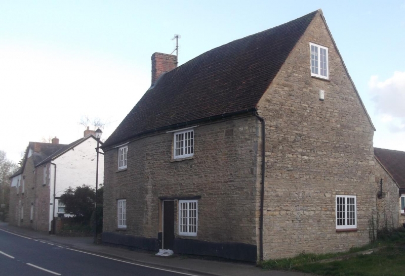
TURVEY BRIDGE STREET
SP 9252-9352 (S. Side)
28/569 No 78
-
GV II
C18 house. Coursed limestone rubble. Banded fishscale and plain old clay
tile roof. 2 bay. Two storeys. N elevation: first floor two 2-light
casement windows with glazing bars, same to ground floor.
Listing NGR: SP9395152393
External links are from the relevant listing authority and, where applicable, Wikidata. Wikidata IDs may be related buildings as well as this specific building. If you want to add or update a link, you will need to do so by editing the Wikidata entry.


Other nearby listed buildings
