Approximate Location Map
Large Map »
Latitude: 53.0663 / 53°3'58"N
Longitude: -2.5206 / 2°31'14"W
OS Eastings: 365214
OS Northings: 352242
OS Grid: SJ652522
Mapcode National: GBR 7T.BS9G
Mapcode Global: WH9BB.76Z4
Plus Code: 9C5V3F8H+GQ
Entry Name: 21 and 23, Hospital Street
Listing Date: 1 March 1974
Grade: II
Source: Historic England
Source ID: 1249328
English Heritage Legacy ID: 431185
ID on this website: 101249328
Location: Nantwich, Cheshire East, Cheshire, CW5
County: Cheshire East
Civil Parish: Nantwich
Built-Up Area: Nantwich
Traditional County: Cheshire
Lieutenancy Area (Ceremonial County): Cheshire
Church of England Parish: Nantwich St Mary
Church of England Diocese: Chester
Tagged with: Shop
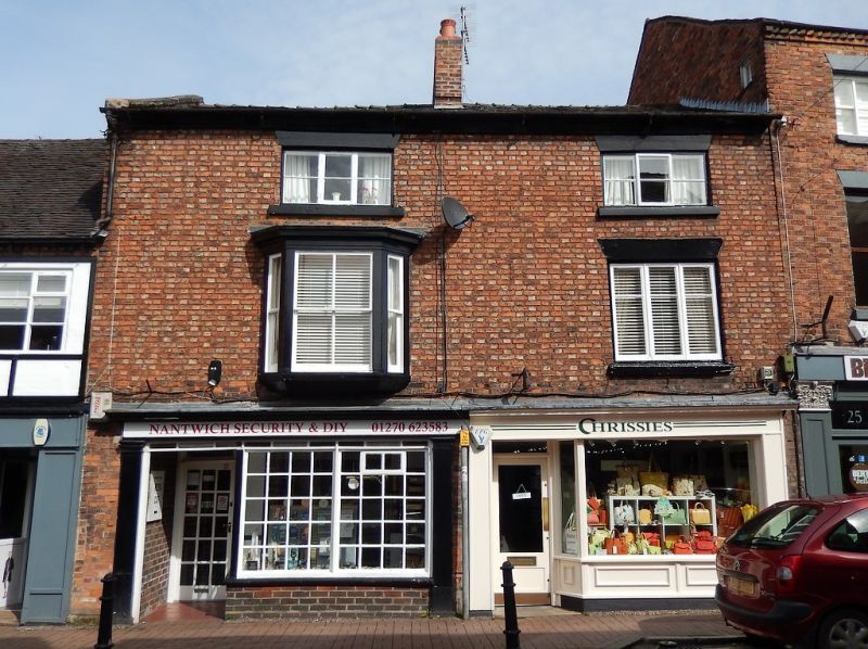
1.
l425 HOSPITAL STREET
(North Side)
---------------
Nos 21 and 23
SJ 6552 1/121
II GV
2.
Early C19 and later, the core probably C18. Redbrick; 3 storeys; 1 canted oriel
window (single glazing bars); moulded stone eaves; slates.Modern shop fronts.
Included for group value.
Lamb Hotel, Nos 9 to 17 (odd) and Nos 21 to 25 (odd) form a group.
Listing NGR: SJ6521652247
External links are from the relevant listing authority and, where applicable, Wikidata. Wikidata IDs may be related buildings as well as this specific building. If you want to add or update a link, you will need to do so by editing the Wikidata entry.


Other nearby listed buildings
