Approximate Location Map
Large Map »
Latitude: 51.4595 / 51°27'34"N
Longitude: -0.1128 / 0°6'46"W
OS Eastings: 531203
OS Northings: 175077
OS Grid: TQ312750
Mapcode National: GBR LZ.TZ
Mapcode Global: VHGR6.0L61
Plus Code: 9C3XFV5P+QV
Entry Name: Pillar Box
Listing Date: 27 January 1987
Grade: II
Source: Historic England
Source ID: 1249680
English Heritage Legacy ID: 431886
ID on this website: 101249680
Location: Brixton, Lambeth, London, SW2
County: London
District: Lambeth
Electoral Ward/Division: Coldharbour
Parish: Non Civil Parish
Built-Up Area: Lambeth
Traditional County: Surrey
Lieutenancy Area (Ceremonial County): Greater London
Church of England Parish: Brixton St Matthew with St Jude
Church of England Diocese: Southwark
Tagged with: Pillar box
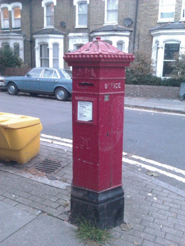
MERVAN ROAD
1. Brixton
TQ 3175 17/3000
Pillar box
II
2.
Pillar box. 1872. Cast iron. Hexagonal with acorn finial.
Listing NGR: TQ3120375077
External links are from the relevant listing authority and, where applicable, Wikidata. Wikidata IDs may be related buildings as well as this specific building. If you want to add or update a link, you will need to do so by editing the Wikidata entry.


Other nearby listed buildings
