Approximate Location Map
Large Map »
Latitude: 51.2244 / 51°13'28"N
Longitude: 1.404 / 1°24'14"E
OS Eastings: 637775
OS Northings: 152757
OS Grid: TR377527
Mapcode National: GBR X1Y.1T2
Mapcode Global: VHMDG.9H26
Plus Code: 9F336CF3+QH
Entry Name: 65, 65A and 67, Beach Street
Listing Date: 8 February 1974
Grade: II
Source: Historic England
Source ID: 1250349
English Heritage Legacy ID: 176952
ID on this website: 101250349
Location: Deal, Dover, Kent, CT14
County: Kent
District: Dover
Civil Parish: Deal
Built-Up Area: Deal
Traditional County: Kent
Lieutenancy Area (Ceremonial County): Kent
Tagged with: Building
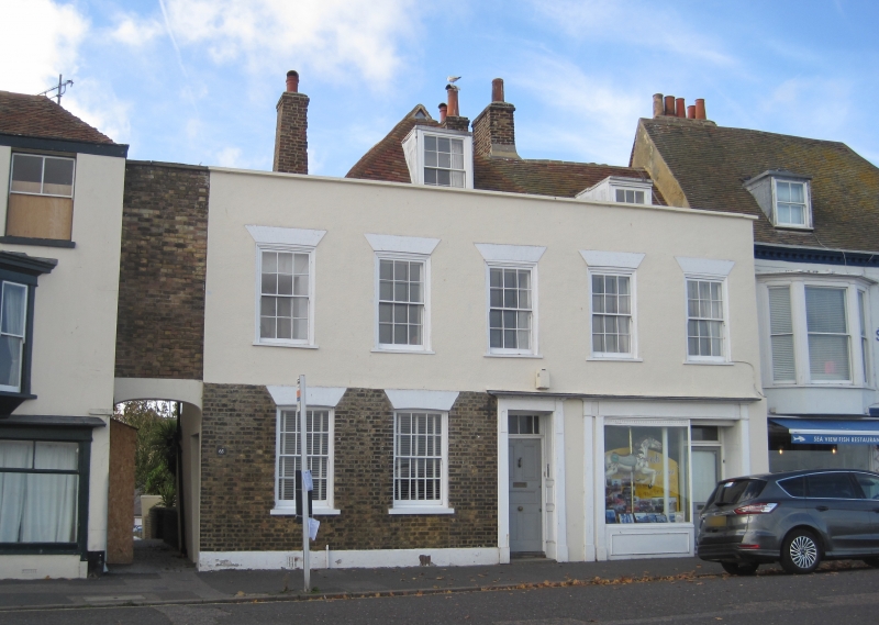
BEACH STREET
1.
lO35
(West Side)
No 65.
No 65A.
No 67.
TR 3752 NE 1/14
II GV
2.
An Cl8 building refronted in mid C19 but still retaining hipped gable with
dormer and another dormer above the later parapet. Old tiled roof. 2 storeys
and attic yellow brick. 5 sashes with glazing bars missing. Later C19 shopfront
in place of the 2 right hand windows.
Nos 59 to 69 (odd) form a group.
Listing NGR: TR3777552757
External links are from the relevant listing authority and, where applicable, Wikidata. Wikidata IDs may be related buildings as well as this specific building. If you want to add or update a link, you will need to do so by editing the Wikidata entry.


Other nearby listed buildings
