Approximate Location Map
Large Map »
Latitude: 51.2792 / 51°16'45"N
Longitude: 1.0815 / 1°4'53"E
OS Eastings: 615005
OS Northings: 157849
OS Grid: TR150578
Mapcode National: GBR TY2.Q7G
Mapcode Global: VHLGM.P3LP
Plus Code: 9F3373HJ+MH
Entry Name: 34, Burgate
Listing Date: 3 May 1967
Grade: II
Source: Historic England
Source ID: 1251586
English Heritage Legacy ID: 170456
ID on this website: 101251586
Location: Canterbury, Kent, CT1
County: Kent
District: Canterbury
Electoral Ward/Division: Westgate
Parish: Non Civil Parish
Built-Up Area: Canterbury
Traditional County: Kent
Lieutenancy Area (Ceremonial County): Kent
Tagged with: Building
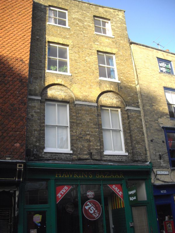
1.
944 BURGATE
(North East Side)
No 34
TR 1557 NW 5/253 3.5.67.
II GV
2.
Late C18. 4 storeys yellow brick. Tiled roof and stone parapet. 2 sashes
with stone cills and verticals only. First floor windows are set in arched
recesses. Later shopfront.
Nos 23 to 37 (consec) and the Christchurch Gateway form a group.
Listing NGR: TR1501657862
External links are from the relevant listing authority and, where applicable, Wikidata. Wikidata IDs may be related buildings as well as this specific building. If you want to add or update a link, you will need to do so by editing the Wikidata entry.


Other nearby listed buildings
