Approximate Location Map
Large Map »
Latitude: 51.3515 / 51°21'5"N
Longitude: -1.9947 / 1°59'40"W
OS Eastings: 400467
OS Northings: 161385
OS Grid: SU004613
Mapcode National: GBR 2V1.6JH
Mapcode Global: VHB4G.C9V7
Plus Code: 9C3W9224+J4
Entry Name: 12A, St John's Alley
Listing Date: 19 September 1972
Grade: II
Source: Historic England
Source ID: 1252258
English Heritage Legacy ID: 435233
ID on this website: 101252258
Location: Devizes, Wiltshire, SN10
County: Wiltshire
Civil Parish: Devizes
Built-Up Area: Devizes
Traditional County: Wiltshire
Lieutenancy Area (Ceremonial County): Wiltshire
Church of England Parish: Devizes St John
Church of England Diocese: Salisbury
Tagged with: Building
1.
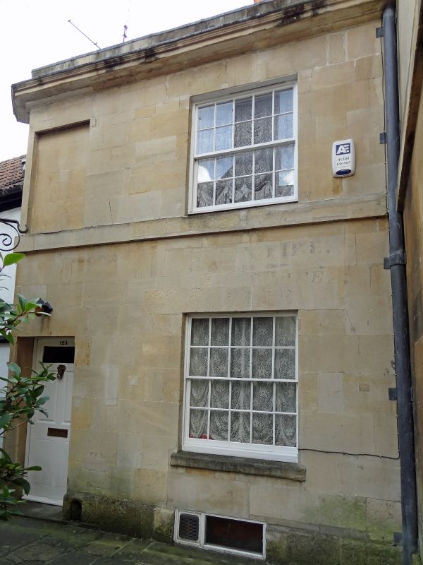
1042 ST JOHN'S ALLEY
(East Side)
No l2A
SU 0061 4/82
II
2.
Early C19. 2 storeys Bath stone on projecting plinth. Band between storeys.
Moulded cornice and blocking course. Gable end slate roof. One window each
floor, recessed sashes 5 panes wide, block sills. Recessed door to left of
5 panels, top panel glazed.
Listing NGR: SU0046761385
External links are from the relevant listing authority and, where applicable, Wikidata. Wikidata IDs may be related buildings as well as this specific building. If you want to add or update a link, you will need to do so by editing the Wikidata entry.


Other nearby listed buildings
