Approximate Location Map
Large Map »
Latitude: 54.4911 / 54°29'27"N
Longitude: -0.6139 / 0°36'49"W
OS Eastings: 489883
OS Northings: 511523
OS Grid: NZ898115
Mapcode National: GBR SJ4H.WV
Mapcode Global: WHG9Y.JCWX
Plus Code: 9C6XF9RP+CC
Entry Name: West Pier
Listing Date: 4 December 1972
Grade: II
Source: Historic England
Source ID: 1253730
English Heritage Legacy ID: 437030
ID on this website: 101253730
Location: Whitby, North Yorkshire, YO21
County: North Yorkshire
District: Scarborough
Civil Parish: Whitby
Built-Up Area: Whitby
Traditional County: Yorkshire
Lieutenancy Area (Ceremonial County): North Yorkshire
Church of England Parish: Whitby St Mary
Church of England Diocese: York
Tagged with: Architectural structure
1.
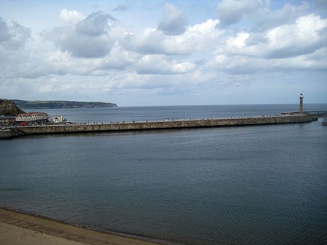
1811 THE PIERS
West Pier
NZ 8911 1/5
II
2.
Rebuilt and lengthened in 1734. Finished in 1814 under the direction of
James Peacock and Jonathan Pickernell. The Battery was formerly mounted
with 6 18-pounder guns, in 1817. -
Listing NGR: NZ8988311523
External links are from the relevant listing authority and, where applicable, Wikidata. Wikidata IDs may be related buildings as well as this specific building. If you want to add or update a link, you will need to do so by editing the Wikidata entry.


Other nearby listed buildings
