Approximate Location Map
Large Map »
Latitude: 51.7984 / 51°47'54"N
Longitude: -2.3219 / 2°19'18"W
OS Eastings: 377898
OS Northings: 211129
OS Grid: SO778111
Mapcode National: GBR 0KJ.7S6
Mapcode Global: VH94P.P2W6
Plus Code: 9C3VQMXH+86
Entry Name: Milepost at National Grid Reference So 779 112
Listing Date: 30 November 1989
Grade: II
Source: Historic England
Source ID: 1253734
English Heritage Legacy ID: 132554
ID on this website: 101253734
Location: Stroud, Gloucestershire, GL2
County: Gloucestershire
District: Stroud
Civil Parish: Moreton Valence
Traditional County: Gloucestershire
Lieutenancy Area (Ceremonial County): Gloucestershire
Church of England Parish: Moreton Valence St Stephen
Church of England Diocese: Gloucester
Tagged with: Milestone
HARESFIELD GLOUCESTER AND
SO 71 SE
SHARPNESS CANAL
3/281
Milepost at NGR SO
779 112
II
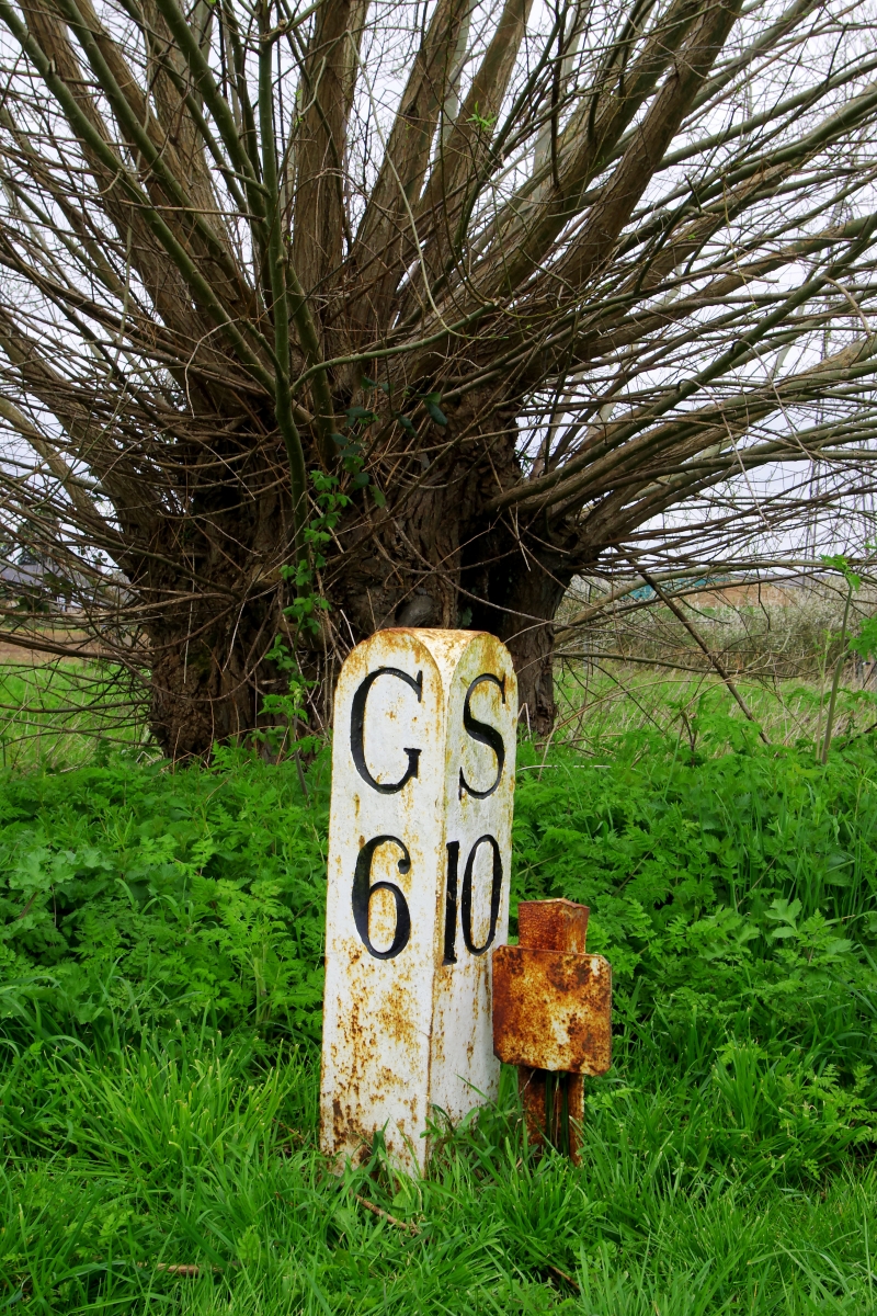
Canal milepost. Circa 1827. Painted, triangular stone post with rounded top.
Incised serif lettering and numbers: On left face, G6; on right face S10.
Listing NGR: SO7789811129
External links are from the relevant listing authority and, where applicable, Wikidata. Wikidata IDs may be related buildings as well as this specific building. If you want to add or update a link, you will need to do so by editing the Wikidata entry.


Other nearby listed buildings
