Approximate Location Map
Large Map »
Latitude: 51.2256 / 51°13'31"N
Longitude: 1.4032 / 1°24'11"E
OS Eastings: 637712
OS Northings: 152877
OS Grid: TR377528
Mapcode National: GBR X1Y.1L3
Mapcode Global: VHMDG.8GNB
Plus Code: 9F336CG3+67
Entry Name: 73, Middle Street
Listing Date: 8 February 1974
Grade: II
Source: Historic England
Source ID: 1253783
English Heritage Legacy ID: 177148
ID on this website: 101253783
Location: Deal, Dover, Kent, CT14
County: Kent
District: Dover
Civil Parish: Deal
Built-Up Area: Deal
Traditional County: Kent
Lieutenancy Area (Ceremonial County): Kent
Tagged with: Building
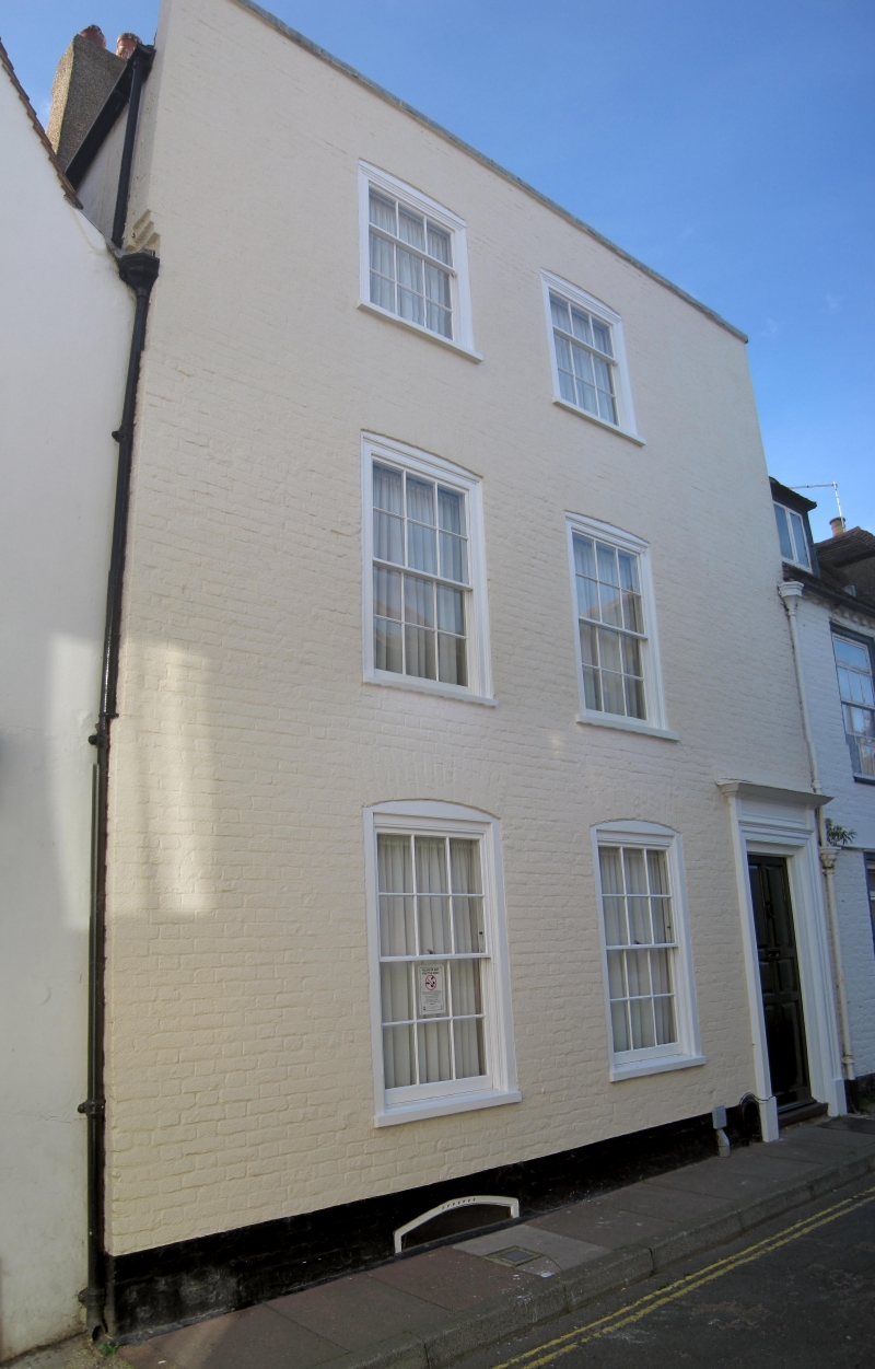
MIDDLE STREET
1.
1035
(West Side)
No 73
TR 3752 NE 1/54
II GV
2.
Early C19. 3 storeys and basement painted brick. Stone parapet. 2 cambered
sashes with glazing bars intact. Right side doorcase set in moulded architrave
with 6 fielded panelled door.
Nos 71 to 75 (odd) form a group.
Listing NGR: TR3771252877
External links are from the relevant listing authority and, where applicable, Wikidata. Wikidata IDs may be related buildings as well as this specific building. If you want to add or update a link, you will need to do so by editing the Wikidata entry.


Other nearby listed buildings
