Approximate Location Map
Large Map »
Latitude: 52.7079 / 52°42'28"N
Longitude: -2.7548 / 2°45'17"W
OS Eastings: 349101
OS Northings: 312514
OS Grid: SJ491125
Mapcode National: GBR BJ.2GGR
Mapcode Global: WH8BT.N6DD
Plus Code: 9C4VP65W+53
Entry Name: 7, Mardol Head
Listing Date: 10 January 1953
Grade: II
Source: Historic England
Source ID: 1254652
English Heritage Legacy ID: 457608
ID on this website: 101254652
Location: Shrewsbury, Shropshire, SY1
County: Shropshire
Civil Parish: Shrewsbury
Built-Up Area: Shrewsbury
Traditional County: Shropshire
Lieutenancy Area (Ceremonial County): Shropshire
Church of England Parish: Shrewsbury St Chad
Church of England Diocese: Lichfield
Tagged with: Building
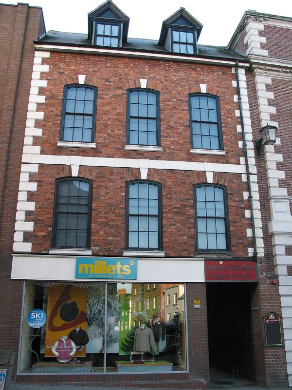
SHREWSBURY
SJ4912NW
653-1/11/429
10/01/53
MARDOL HEAD
(South East side)
No.7
GV
II
House, now shop. Early C18 but largely rebuilt. Brick with
stone dressings and plain tiled roof. 3 storeys, 3-window
range. Inserted modern shop front and 12-pane sash windows
over with cambered heads with stuccoed keystones. String
course to first floor. 2 gabled dormers in roof. Angle quoins.
Listing NGR: SJ4910112514
External links are from the relevant listing authority and, where applicable, Wikidata. Wikidata IDs may be related buildings as well as this specific building. If you want to add or update a link, you will need to do so by editing the Wikidata entry.


Other nearby listed buildings
