Approximate Location Map
Large Map »
Latitude: 51.2804 / 51°16'49"N
Longitude: 1.0809 / 1°4'51"E
OS Eastings: 614958
OS Northings: 157986
OS Grid: TR149579
Mapcode National: GBR TY2.Q2M
Mapcode Global: VHLGM.P28R
Plus Code: 9F3373JJ+59
Entry Name: 7, Palace Street
Listing Date: 7 September 1973
Grade: II
Source: Historic England
Source ID: 1255547
English Heritage Legacy ID: 459875
ID on this website: 101255547
Location: Canterbury, Kent, CT1
County: Kent
District: Canterbury
Electoral Ward/Division: Westgate
Parish: Non Civil Parish
Built-Up Area: Canterbury
Traditional County: Kent
Lieutenancy Area (Ceremonial County): Kent
Tagged with: Building
1.
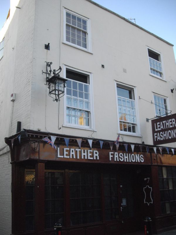
944 PALACE STREET
(West Side)
No 7
TR 1457 NE 4/280
II GV
2.
C18 facade to a timber-framed building. 3 storeys stuccoed. Stone coping
2 to 3 restored sashes. Early C19 shop front has a cornice with brackets,
panelled risers and reeded pilasters. The interior has C18 embossed plasterwork
on the ceiling, a finely moulded doorcase and a corner cupboard.
Nos 1, 2 and Nos 4 to 8 (consec) form a group.
Listing NGR: TR1494757994
External links are from the relevant listing authority and, where applicable, Wikidata. Wikidata IDs may be related buildings as well as this specific building. If you want to add or update a link, you will need to do so by editing the Wikidata entry.


Other nearby listed buildings
