Approximate Location Map
Large Map »
Latitude: 51.2522 / 51°15'7"N
Longitude: -0.0669 / 0°4'0"W
OS Eastings: 535005
OS Northings: 152114
OS Grid: TQ350521
Mapcode National: GBR KKB.FXR
Mapcode Global: VHGS5.SSJF
Plus Code: 9C3X7W2M+V7
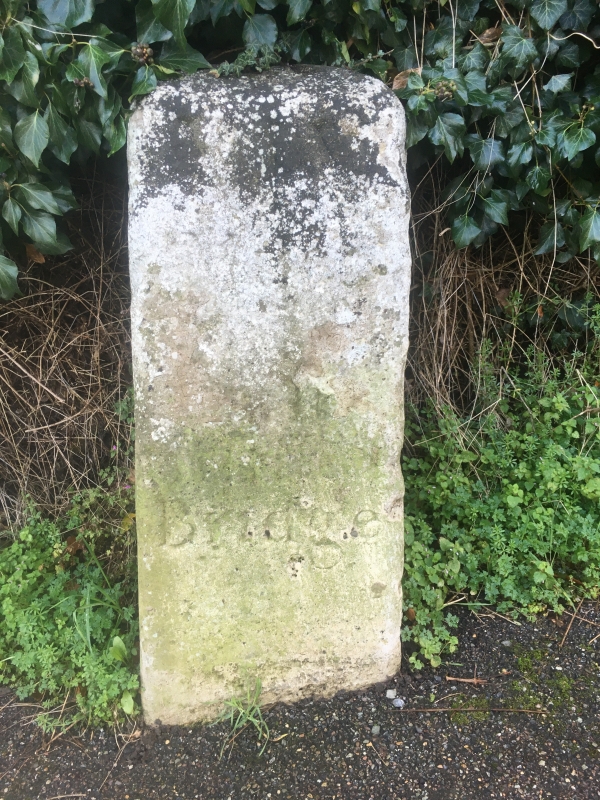
Entry Name: Milestone
Listing Date: 27 February 1997
Grade: II
Source: Historic England
Source ID: 1257943
English Heritage Legacy ID: 463294
ID on this website: 101257943
Location: Tyler's Green, Tandridge, Surrey, RH9
County: Surrey
District: Tandridge
Civil Parish: Godstone
Built-Up Area: Godstone
Traditional County: Surrey
Lieutenancy Area (Ceremonial County): Surrey
Church of England Parish: Godstone and Blindley Heath
Church of England Diocese: Southwark
Tagged with: Milestone
TQ 35 SE GODSTONE HIGH STREET
303-/6/10026 Milestone
II
Milestone, dated 1744, with cambered top. Inscription to one side reads 'XX Miles From the Standard at Cornhill, LONDON - 1744'. Inscriptions to other sides less legible.
Listing NGR: TQ3500552114
External links are from the relevant listing authority and, where applicable, Wikidata. Wikidata IDs may be related buildings as well as this specific building. If you want to add or update a link, you will need to do so by editing the Wikidata entry.


Other nearby listed buildings
