Approximate Location Map
Large Map »
Latitude: 51.4209 / 51°25'15"N
Longitude: -1.7314 / 1°43'53"W
OS Eastings: 418772
OS Northings: 169128
OS Grid: SU187691
Mapcode National: GBR 4X2.T87
Mapcode Global: VHB46.YK14
Plus Code: 9C3WC7C9+8C
Entry Name: 127, High Street
Listing Date: 18 July 1949
Grade: II
Source: Historic England
Source ID: 1258201
English Heritage Legacy ID: 310379
ID on this website: 101258201
Location: Marlborough, Wiltshire, SN8
County: Wiltshire
Civil Parish: Marlborough
Built-Up Area: Marlborough
Traditional County: Wiltshire
Lieutenancy Area (Ceremonial County): Wiltshire
Tagged with: Building
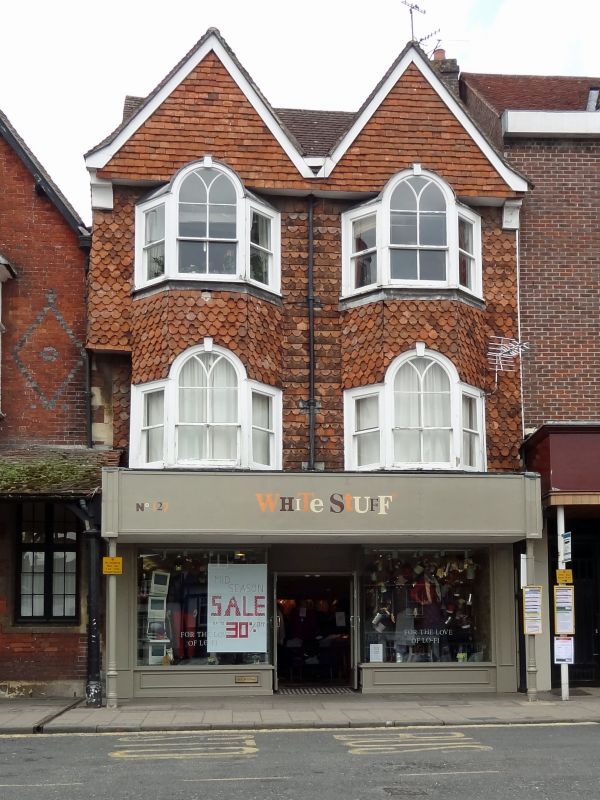
HIGH STREET
1.
5407
(North Side)
No 127
SU 1869 1/37 18.7.49.
II
2.
C16 altered Cl8 and later. 3 storey. Timber frame, tile hung (shaped tiles)
with pair of overhanging gables. Old tile roof. 2 2-storey angular bays with
Palladian windows on lst and 2nd floor, glazing slightly altered. Poor modern
shop front on ground floor.
Listing NGR: SU1876369134
External links are from the relevant listing authority and, where applicable, Wikidata. Wikidata IDs may be related buildings as well as this specific building. If you want to add or update a link, you will need to do so by editing the Wikidata entry.


Other nearby listed buildings
