Approximate Location Map
Large Map »
Latitude: 51.196 / 51°11'45"N
Longitude: 0.2112 / 0°12'40"E
OS Eastings: 554598
OS Northings: 146408
OS Grid: TQ545464
Mapcode National: GBR MNY.S8R
Mapcode Global: VHHQ5.M60H
Plus Code: 9F3256W6+9F
Entry Name: South Wall to Hall Place Park
Listing Date: 16 January 1975
Grade: II
Source: Historic England
Source ID: 1258588
English Heritage Legacy ID: 445265
ID on this website: 101258588
Location: Leigh, Sevenoaks, Kent, TN11
County: Kent
District: Sevenoaks
Civil Parish: Leigh
Built-Up Area: Leigh
Traditional County: Kent
Lieutenancy Area (Ceremonial County): Kent
Church of England Parish: Leigh
Church of England Diocese: Rochester
Tagged with: Wall
LEIGH LEIGH
1.
5280
High Street
(North Side)
South Wall to
Hall Place Park
TQ 5446 19/669
II
2.
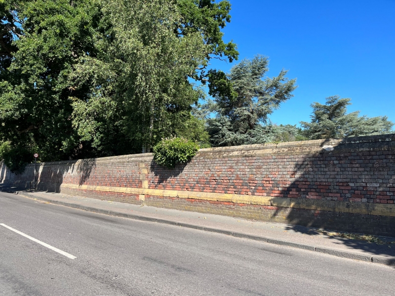
Mid Cl9 wall of red brick with diaper of blue headers. Stone coping in 2 planes.
High, stone-coped plinth.
Listing NGR: TQ5459846408
External links are from the relevant listing authority and, where applicable, Wikidata. Wikidata IDs may be related buildings as well as this specific building. If you want to add or update a link, you will need to do so by editing the Wikidata entry.


Other nearby listed buildings
