Approximate Location Map
Large Map »
Latitude: 52.1765 / 52°10'35"N
Longitude: -2.1828 / 2°10'58"W
OS Eastings: 387593
OS Northings: 253150
OS Grid: SO875531
Mapcode National: GBR 1GD.DZB
Mapcode Global: VH92V.3KWC
Plus Code: 9C4V5RG8+HV
Entry Name: Whittington Grange
Listing Date: 3 August 1972
Grade: II
Source: Historic England
Source ID: 1259110
English Heritage Legacy ID: 445432
ID on this website: 101259110
Location: Wychavon, Worcestershire, WR5
County: Worcestershire
District: Wychavon
Civil Parish: Whittington
Traditional County: Worcestershire
Lieutenancy Area (Ceremonial County): Worcestershire
Church of England Parish: Worcester, St Martin with St Peter and Whittington
Church of England Diocese: Worcester
Tagged with: Building
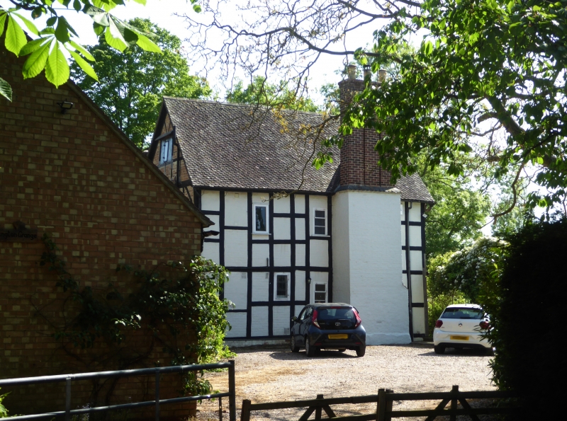
WHITTINGTON WHITTINGTON
1.
2301
SO 95 SE 4/871
Whittington Grange
II
2.
Formerly shown as the Ferns. Cl7 and later. T shaped plan. The gabled
cross wing at the head is of timber framing. The stem is whitened brick
and rough.cast. Gabled dormers. Pierced Victorian bargeboards. Tile roof.
Listing NGR: SO8759353150
External links are from the relevant listing authority and, where applicable, Wikidata. Wikidata IDs may be related buildings as well as this specific building. If you want to add or update a link, you will need to do so by editing the Wikidata entry.


Other nearby listed buildings
