Approximate Location Map
Large Map »
Latitude: 51.2803 / 51°16'48"N
Longitude: 1.0804 / 1°4'49"E
OS Eastings: 614925
OS Northings: 157964
OS Grid: TR149579
Mapcode National: GBR TY2.PZ3
Mapcode Global: VHLGM.P20W
Plus Code: 9F3373JJ+45
Entry Name: 17, Orange Street
Listing Date: 7 September 1973
Grade: II
Source: Historic England
Source ID: 1260533
English Heritage Legacy ID: 440416
ID on this website: 101260533
Location: Canterbury, Kent, CT1
County: Kent
District: Canterbury
Electoral Ward/Division: Westgate
Parish: Non Civil Parish
Built-Up Area: Canterbury
Traditional County: Kent
Lieutenancy Area (Ceremonial County): Kent
Tagged with: Building
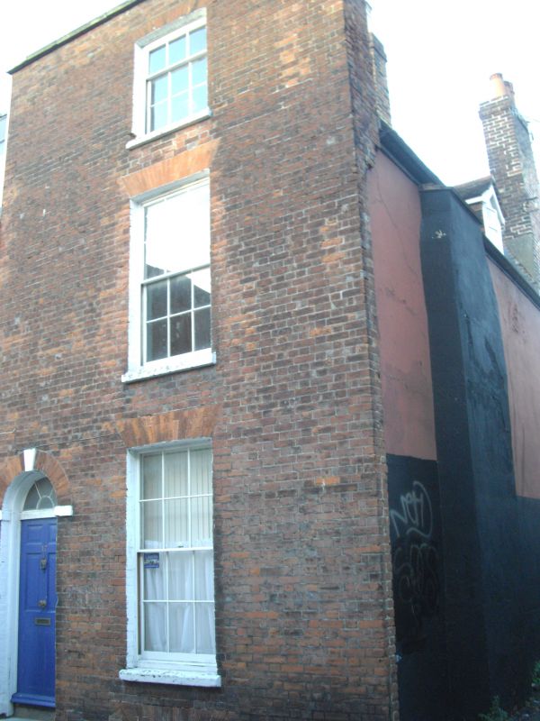
1.
944 ORANGE STREET
(North West Side)
No 17
TR 1457 NE 4/627
II GV
2.
Late C18. 3 storeys red brick. Parapet. 1 sash with glazing bars intact.
Simple round-headed doorcase with semi-circular fanlight. Side elevation
has 1 hipped dormer.
Nos 9, 10, Nos 13 to 17 (consec) and Nos 19, 19A and 20 form a group.
Listing NGR: TR1493257972
External links are from the relevant listing authority and, where applicable, Wikidata. Wikidata IDs may be related buildings as well as this specific building. If you want to add or update a link, you will need to do so by editing the Wikidata entry.


Other nearby listed buildings
