Approximate Location Map
Large Map »
Latitude: 51.2715 / 51°16'17"N
Longitude: 1.0881 / 1°5'17"E
OS Eastings: 615502
OS Northings: 157009
OS Grid: TR155570
Mapcode National: GBR TY8.CWL
Mapcode Global: VHLGM.T92M
Plus Code: 9F3373CQ+H6
Entry Name: 81A, Old Dover Road
Listing Date: 7 September 1973
Grade: II
Source: Historic England
Source ID: 1260633
English Heritage Legacy ID: 440162
ID on this website: 101260633
Location: St Martin's, Canterbury, Kent, CT1
County: Kent
District: Canterbury
Electoral Ward/Division: Barton
Parish: Non Civil Parish
Built-Up Area: Canterbury
Traditional County: Kent
Lieutenancy Area (Ceremonial County): Kent
Tagged with: Building
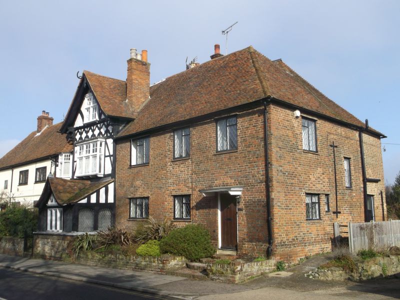
1.
944 OLD DOVER ROAD
(North East Side)
No 81A
TR 1557 SW 9/617
TR 15 NE 10/617
II GV
2.
2 parallel ranges. Red brick with tiled roof. The windows have been greatly
restored.
Nos 77 to 81A (odd) form a group.
Listing NGR: TR1550257009
External links are from the relevant listing authority and, where applicable, Wikidata. Wikidata IDs may be related buildings as well as this specific building. If you want to add or update a link, you will need to do so by editing the Wikidata entry.


Other nearby listed buildings
