Approximate Location Map
Large Map »
Latitude: 51.2835 / 51°17'0"N
Longitude: 1.0778 / 1°4'40"E
OS Eastings: 614731
OS Northings: 158315
OS Grid: TR147583
Mapcode National: GBR TY2.HBB
Mapcode Global: VHLGF.MZNZ
Plus Code: 9F3373MH+94
Entry Name: 37, North Lane
Listing Date: 7 September 1973
Grade: II
Source: Historic England
Source ID: 1260684
English Heritage Legacy ID: 440069
ID on this website: 101260684
Location: Canterbury, Kent, CT2
County: Kent
District: Canterbury
Electoral Ward/Division: Westgate
Parish: Non Civil Parish
Built-Up Area: Canterbury
Traditional County: Kent
Lieutenancy Area (Ceremonial County): Kent
Tagged with: Building
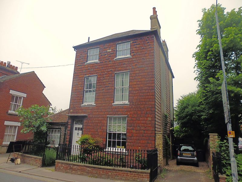
1.
944 NORTH LANE
(North West Side)
No 37
TR 1458 SE 2/129
II
2.
Early C19. 3 storeys tile hung. Ripped roof. 2 sashes with glazing bars
intact. Left hand doorcase has vestigial weather hoed, rectangular fanlight
and pilasters. 6 panelled door. 3 stone steps.
Listing NGR: TR1472558315
External links are from the relevant listing authority and, where applicable, Wikidata. Wikidata IDs may be related buildings as well as this specific building. If you want to add or update a link, you will need to do so by editing the Wikidata entry.


Other nearby listed buildings
