Approximate Location Map
Large Map »
Latitude: 51.2838 / 51°17'1"N
Longitude: 1.0699 / 1°4'11"E
OS Eastings: 614178
OS Northings: 158322
OS Grid: TR141583
Mapcode National: GBR TY2.FB7
Mapcode Global: VHLGF.HZHR
Plus Code: 9F3373M9+GX
Entry Name: Paving and Cobbles in Front of Nos 1 to 15
Listing Date: 7 September 1973
Grade: II
Source: Historic England
Source ID: 1260735
English Heritage Legacy ID: 439639
ID on this website: 101260735
Location: St Dunstan's, Canterbury, Kent, CT2
County: Kent
District: Canterbury
Electoral Ward/Division: Westgate
Parish: Non Civil Parish
Built-Up Area: Canterbury
Traditional County: Kent
Lieutenancy Area (Ceremonial County): Kent
Tagged with: Architectural structure
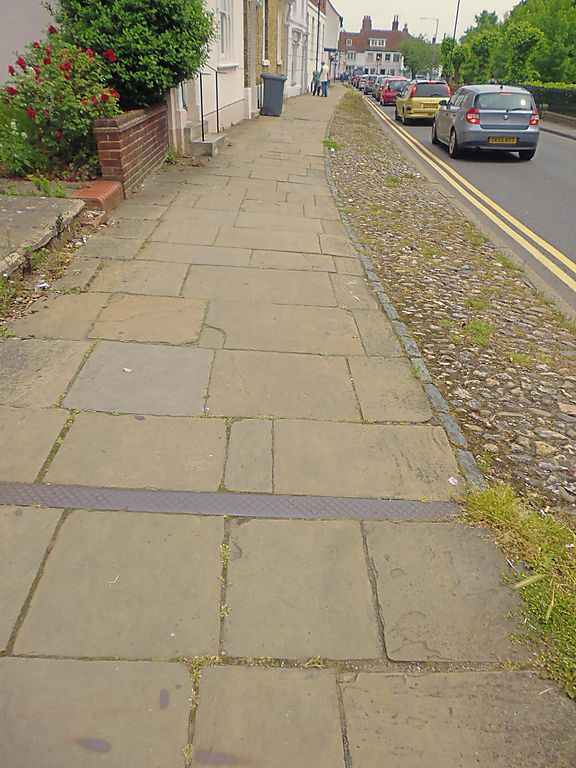
1.
944 LONDON ROAD
(North West Side)
Paving & cobbles in front
of Nos 1 to 15 (consec)
TR 1458 SW 1/539
II GV
2.
Cobbled bark and original paving stones. Group value with Nos 1-15.
Nos 1 to 15 (consec) paving and cobbles in front of Nos 1 to 15 (consec)
together with Nos 1 & 3 Whitstable Road form a group.
Listing NGR: TR1417858322
External links are from the relevant listing authority and, where applicable, Wikidata. Wikidata IDs may be related buildings as well as this specific building. If you want to add or update a link, you will need to do so by editing the Wikidata entry.


Other nearby listed buildings
