Approximate Location Map
Large Map »
Latitude: 51.2834 / 51°17'0"N
Longitude: 1.0686 / 1°4'7"E
OS Eastings: 614089
OS Northings: 158276
OS Grid: TR140582
Mapcode National: GBR TY2.F0H
Mapcode Global: VHLGM.G0SH
Plus Code: 9F3373M9+8C
Entry Name: 27-33, London Road
Listing Date: 7 September 1973
Grade: II
Source: Historic England
Source ID: 1260737
English Heritage Legacy ID: 439643
ID on this website: 101260737
Location: St Dunstan's, Canterbury, Kent, CT2
County: Kent
District: Canterbury
Electoral Ward/Division: Westgate
Parish: Non Civil Parish
Built-Up Area: Canterbury
Traditional County: Kent
Lieutenancy Area (Ceremonial County): Kent
Tagged with: Building
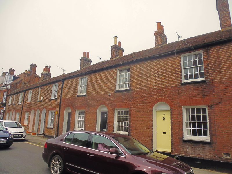
1.
944 LONDON ROAD
(North West Side)
Nos 27 to 33 (consec)
TR 1458 SW 1/541
II GV
2.
C18. 2 storeys red brick. Tiled roof. 1 sash each with glazing bars intact
and stone cills, 2 blanks. Simple round-headed doorcases and 4 panelled doors,
2 steps. Plinth. Footscraper.
Nos 25 to 33 (consec) form a group.
Listing NGR: TR1409658281
External links are from the relevant listing authority and, where applicable, Wikidata. Wikidata IDs may be related buildings as well as this specific building. If you want to add or update a link, you will need to do so by editing the Wikidata entry.


Other nearby listed buildings
