Approximate Location Map
Large Map »
Latitude: 51.277 / 51°16'37"N
Longitude: 1.0855 / 1°5'7"E
OS Eastings: 615295
OS Northings: 157613
OS Grid: TR152576
Mapcode National: GBR TY2.Z4G
Mapcode Global: VHLGM.R5QF
Plus Code: 9F3373GP+Q5
Entry Name: Micawber's
Listing Date: 7 September 1973
Grade: II
Source: Historic England
Source ID: 1260806
English Heritage Legacy ID: 439402
ID on this website: 101260806
Location: Canterbury, Kent, CT1
County: Kent
District: Canterbury
Electoral Ward/Division: Barton
Parish: Non Civil Parish
Built-Up Area: Canterbury
Traditional County: Kent
Lieutenancy Area (Ceremonial County): Kent
Tagged with: Building
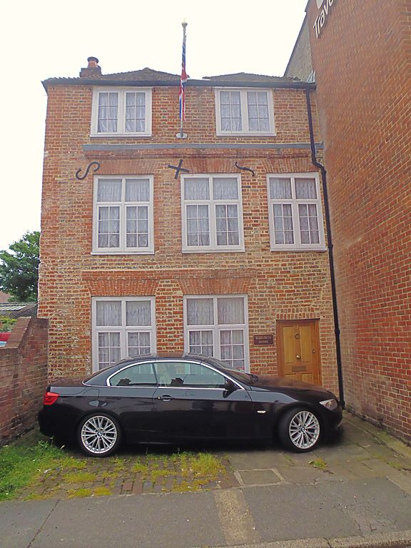
1.
944 IVY LANE
(South Side)
No 60
No 61
(Micawber's)
TR 1557 NW 5/338
II GV
2.
Early C18, 3 storeys painted brick. Tiled roof in 2 hips. 2 casements,
Stringcourses. Simple right side doorcase. Part paved forecourt bounded
by wooden posts.
Nos 40A to 45 (consec), NO 51, No 51A, Nos 53 to 61 (consec) and
No 63 form a group.
Listing NGR: TR1529757614
External links are from the relevant listing authority and, where applicable, Wikidata. Wikidata IDs may be related buildings as well as this specific building. If you want to add or update a link, you will need to do so by editing the Wikidata entry.


Other nearby listed buildings
