Approximate Location Map
Large Map »
Latitude: 51.946 / 51°56'45"N
Longitude: 1.0776 / 1°4'39"E
OS Eastings: 611608
OS Northings: 231972
OS Grid: TM116319
Mapcode National: GBR TNY.WTK
Mapcode Global: VHLCB.MCJ1
Plus Code: 9F33W3WH+92
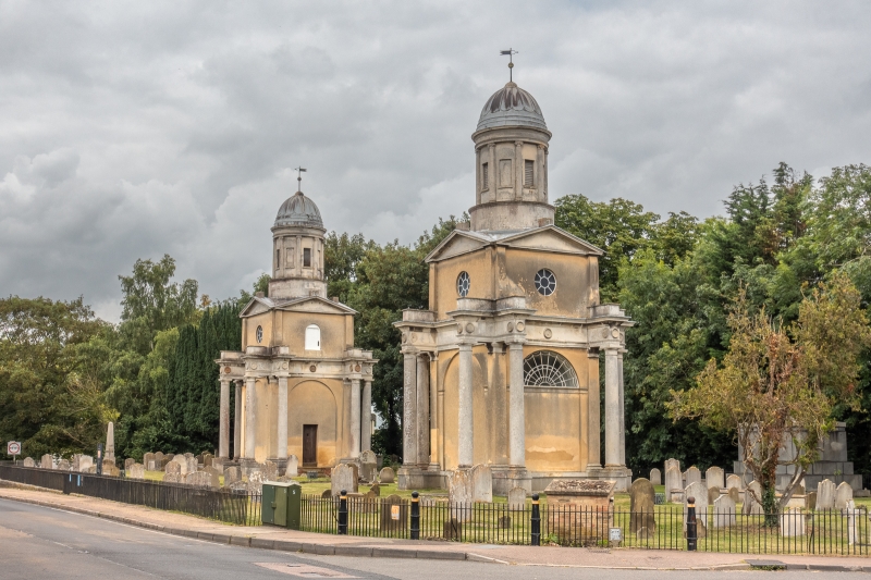
Entry Name: Mistley Towers, South East Tower
Listing Date: 17 November 1966
Grade: I
Source: Historic England
Source ID: 1261061
English Heritage Legacy ID: 438738
ID on this website: 101261061
Location: Mistley, Tendring, Essex, CO11
County: Essex
District: Tendring
Civil Parish: Mistley
Built-Up Area: Mistley
Traditional County: Essex
Lieutenancy Area (Ceremonial County): Essex
Church of England Parish: Mistley with Manningtree St Mary and St Michael
Church of England Diocese: Chelmsford
Tagged with: Former church Church tower Tower
MISTLEY THE WALLS
TM 1131
10/266 Mistley Towers. South
east tower
17/11/66
GV I
Tower. One of a pair. As for the north west tower q.v. 10/265 with the
exception of a door to the first stage. q.v. 3/227.
Listing NGR: TM1160831972
External links are from the relevant listing authority and, where applicable, Wikidata. Wikidata IDs may be related buildings as well as this specific building. If you want to add or update a link, you will need to do so by editing the Wikidata entry.


Other nearby listed buildings
