Approximate Location Map
Large Map »
Latitude: 50.9515 / 50°57'5"N
Longitude: 0.735 / 0°44'6"E
OS Eastings: 592200
OS Northings: 120463
OS Grid: TQ922204
Mapcode National: GBR RZ1.6N4
Mapcode Global: FRA D6FL.G65
Plus Code: 9F22XP2P+J2
Entry Name: 109, High Street
Listing Date: 11 September 1972
Grade: II
Source: Historic England
Source ID: 1262641
English Heritage Legacy ID: 434516
ID on this website: 101262641
Location: Rye, Rother, East Sussex, TN31
County: East Sussex
District: Rother
Civil Parish: Rye
Built-Up Area: Rye
Traditional County: Sussex
Lieutenancy Area (Ceremonial County): East Sussex
Church of England Parish: Rye
Church of England Diocese: Chichester
Tagged with: Building
TQ 9220
1/223
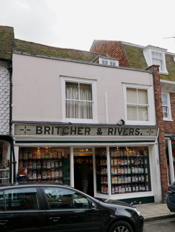
HIGH STREET (South Side)
No 109
GV
II
Early C19 facade to an older house. Two storeys and dormer. Two windows.Tiled roof. Top storey has a parapet and is plastered and painted. Sash windows. Modern (first quarter of C20) shop front.
Nos 106 to 114 (consec) form a group.
Listing NGR: TQ9220020459
External links are from the relevant listing authority and, where applicable, Wikidata. Wikidata IDs may be related buildings as well as this specific building. If you want to add or update a link, you will need to do so by editing the Wikidata entry.


Other nearby listed buildings
