Approximate Location Map
Large Map »
Latitude: 51.489 / 51°29'20"N
Longitude: -0.1638 / 0°9'49"W
OS Eastings: 527584
OS Northings: 178270
OS Grid: TQ275782
Mapcode National: GBR 7N.DD
Mapcode Global: VHGQZ.3TSX
Plus Code: 9C3XFRQP+HF
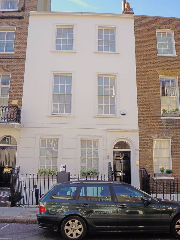
Entry Name: 45, Smith Street SW3
Listing Date: 15 April 1969
Grade: II
Source: Historic England
Source ID: 1265730
English Heritage Legacy ID: 424117
ID on this website: 101265730
Location: Chelsea, Kensington and Chelsea, London, SW3
County: London
District: Kensington and Chelsea
Electoral Ward/Division: Royal Hospital
Parish: Non Civil Parish
Built-Up Area: Kensington and Chelsea
Traditional County: Middlesex
Lieutenancy Area (Ceremonial County): Greater London
Church of England Parish: St Luke and Christ Church Chelsea
Church of England Diocese: London
Tagged with: Building
TQ 2778 SE SMITH STREET SW3
57/11
15.4.69 No 45
II
House. C18 late. Three storeys 2 windows wide. Stucco. Arched recessed entrance.
Architraves to square headed windows. Glazing bars.
Listing NGR: TQ2758478270
External links are from the relevant listing authority and, where applicable, Wikidata. Wikidata IDs may be related buildings as well as this specific building. If you want to add or update a link, you will need to do so by editing the Wikidata entry.


Other nearby listed buildings
