Approximate Location Map
Large Map »
Latitude: 52.3448 / 52°20'41"N
Longitude: 1.507 / 1°30'25"E
OS Eastings: 638967
OS Northings: 277649
OS Grid: TM389776
Mapcode National: GBR XNN.XH9
Mapcode Global: VHM73.2BJ9
Plus Code: 9F438GV4+WQ
Entry Name: Outbuilding to Number 1
Listing Date: 18 July 1972
Grade: II
Source: Historic England
Source ID: 1267220
English Heritage Legacy ID: 419148
ID on this website: 101267220
Location: Halesworth, East Suffolk, IP19
County: Suffolk
District: East Suffolk
Civil Parish: Halesworth
Built-Up Area: Halesworth
Traditional County: Suffolk
Lieutenancy Area (Ceremonial County): Suffolk
Church of England Parish: Halesworth St Mary
Church of England Diocese: St.Edmundsbury and Ipswich
Tagged with: Appendage
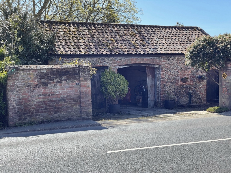
1. QUAY STREET
1163 (South Side)
Outbuilding to No 1
TM 3877 2/53A
II
2.
C18 outbuilding, now garage 1 storey. Pantile roof.
Listing NGR: TM3896577648
External links are from the relevant listing authority and, where applicable, Wikidata. Wikidata IDs may be related buildings as well as this specific building. If you want to add or update a link, you will need to do so by editing the Wikidata entry.


Other nearby listed buildings
