Approximate Location Map
Large Map »
Latitude: 51.584 / 51°35'2"N
Longitude: -2.0988 / 2°5'55"W
OS Eastings: 393252
OS Northings: 187237
OS Grid: ST932872
Mapcode National: GBR 2QZ.Q5T
Mapcode Global: VH95S.KGT3
Plus Code: 9C3VHWM2+HF
Entry Name: St Pauls Bell Tower
Listing Date: 18 January 1949
Grade: I
Source: Historic England
Source ID: 1269428
English Heritage Legacy ID: 460798
Also known as: St Paul's Church tower and site of church
ID on this website: 101269428
Location: Malmesbury, Wiltshire, SN16
County: Wiltshire
Civil Parish: Malmesbury
Built-Up Area: Malmesbury
Traditional County: Wiltshire
Lieutenancy Area (Ceremonial County): Wiltshire
Church of England Parish: Malmesbury and Brokenborough
Church of England Diocese: Bristol
Tagged with: Church tower
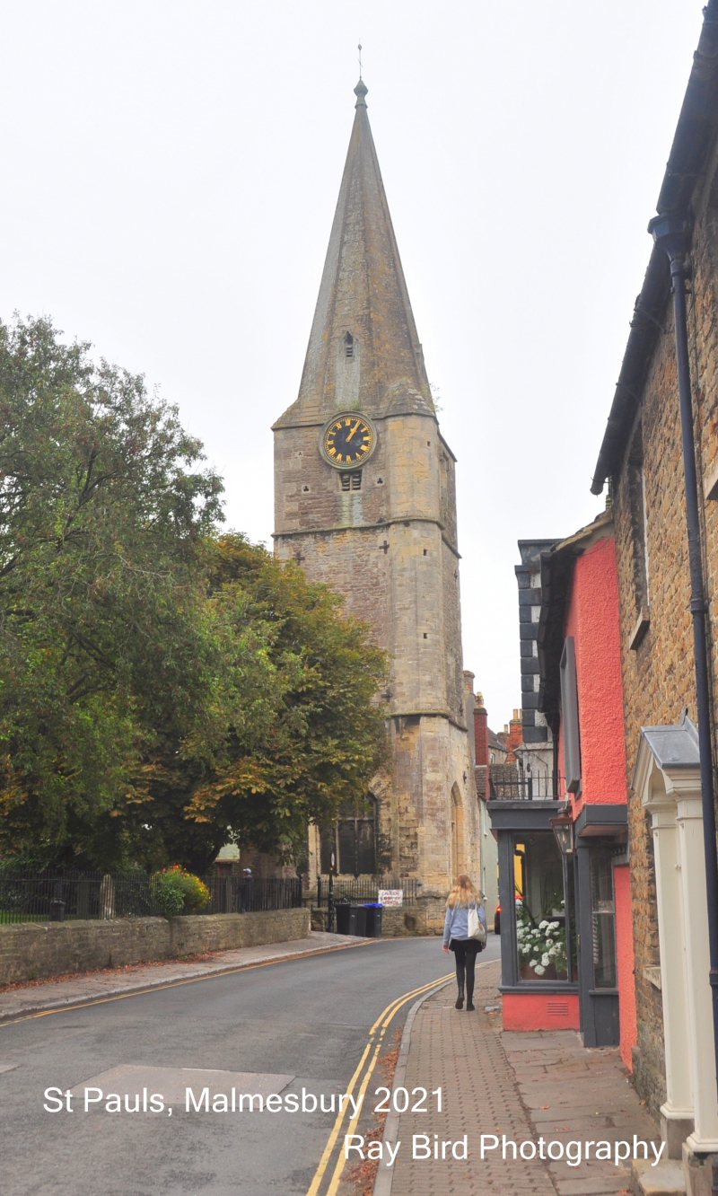
MALMESBURY
ST9387 GLOUCESTER STREET
758-1/4/135 (East side)
18/01/49 St Paul's Bell Tower
GV I
Former church tower. C15. Limestone rubble with ashlar
dressings.
STYLE: Perpendicular Gothic.
PLAN: square plan.
EXTERIOR: in 3 stages divided by drips, with a NW octagonal
stair turret, with clocks beneath a broach spire with 2 tiers
of lucarnes. The E side has C19 angle buttresses to the lower
stages, a 2-centre arched doorway within a blocked arch,
beneath a sloping roof line; the third stage has a 2-light
louvre window. Bottom stage of the N elevation has a blocked
shallow 3-light, 2-centre arch window with Perpendicular
tracery above the transom. Similar W elevation has a 3-light
mullion window to the third stage and a left-hand buttress to
the bottom stage. The S side has a window as the W.
INTERIOR: not inspected.
HISTORICAL NOTE: formerly tower of St Paul's Church, named
1191, on the site of St Aldhelm's monastery church. Nave
collapsed by early C16, used as private house and town hall
until c1623, chancel pulled down 1852. Originally 6-bay nave,
2-bay chancel and N aisle, with the tower at the NW corner.
The arcade built c1250-70 (cf No.11 Gloucester Street, qv).
(Victoria History of the Counties of England: Crowley DA:
Wiltshire: 1991-: 157).
Listing NGR: ST9325487235
External links are from the relevant listing authority and, where applicable, Wikidata. Wikidata IDs may be related buildings as well as this specific building. If you want to add or update a link, you will need to do so by editing the Wikidata entry.


Other nearby listed buildings
