Approximate Location Map
Large Map »
Latitude: 50.1507 / 50°9'2"N
Longitude: -5.0677 / 5°4'3"W
OS Eastings: 180940
OS Northings: 32359
OS Grid: SW809323
Mapcode National: GBR ZD.TPYV
Mapcode Global: FRA 088M.9J6
Plus Code: 9C2P5W2J+7W
Entry Name: Road Frontage Walls to Nos. 1 and 2
Listing Date: 24 April 1996
Grade: II
Source: Historic England
Source ID: 1269953
English Heritage Legacy ID: 460244
ID on this website: 101269953
Location: Falmouth, Cornwall, TR11
County: Cornwall
Civil Parish: Falmouth
Built-Up Area: Falmouth
Traditional County: Cornwall
Lieutenancy Area (Ceremonial County): Cornwall
Church of England Parish: Falmouth King Charles the Martyr
Church of England Diocese: Truro
Tagged with: Architectural structure
FALMOUTH
SW8032SE WODEHOUSE TERRACE
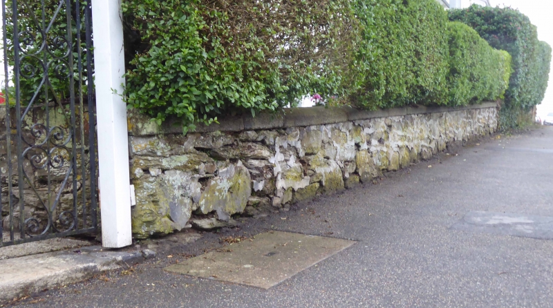
843-1/10/223 Road frontage walls to Nos.1 and 2
GV II
Road frontage walls. Early/mid C19. Killas rubble with
chamfered granite dressings. Included for group value.
Listing NGR: SW8094032359
External links are from the relevant listing authority and, where applicable, Wikidata. Wikidata IDs may be related buildings as well as this specific building. If you want to add or update a link, you will need to do so by editing the Wikidata entry.


Other nearby listed buildings
