Approximate Location Map
Large Map »
Latitude: 51.2867 / 51°17'11"N
Longitude: 0.2511 / 0°15'3"E
OS Eastings: 557072
OS Northings: 156576
OS Grid: TQ570565
Mapcode National: GBR WN.MZN
Mapcode Global: VHHPM.9XLJ
Plus Code: 9F3277P2+MC
Entry Name: Crockers
Listing Date: 10 September 1954
Last Amended: 20 September 1976
Grade: II
Source: Historic England
Source ID: 1272780
English Heritage Legacy ID: 447421
ID on this website: 101272780
Location: Styants Bottom, Sevenoaks, Kent, TN15
County: Kent
District: Sevenoaks
Civil Parish: Seal
Traditional County: Kent
Lieutenancy Area (Ceremonial County): Kent
Church of England Parish: St Lawrence, Seal Chart
Church of England Diocese: Rochester
Tagged with: Building
1.
5280 SEAL STYANTS BOTTOM
Crockers
TQ 55 NE 43/1069 10.9.54
II
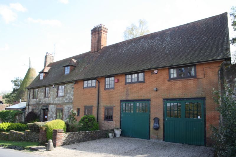
2.
C18. 2 storeys, attic and basement, 3 windows. Tiled roof with left ridge
stack and 2 hipped dormers. Galletted coursed freestone. Brick band and quoins,
brick-coped plinth. C19 casements. 6-panel door under bracketed cornice hood.
Large modern red brick extensions at right.
Listing NGR: TQ5707256576
External links are from the relevant listing authority and, where applicable, Wikidata. Wikidata IDs may be related buildings as well as this specific building. If you want to add or update a link, you will need to do so by editing the Wikidata entry.


Other nearby listed buildings
