Approximate Location Map
Large Map »
Latitude: 51.4207 / 51°25'14"N
Longitude: -1.7287 / 1°43'43"W
OS Eastings: 418959
OS Northings: 169113
OS Grid: SU189691
Mapcode National: GBR 4X2.V1T
Mapcode Global: VHB46.ZKG7
Plus Code: 9C3WC7CC+7G
Entry Name: Congregational Chapel
Listing Date: 21 October 1974
Grade: II
Source: Historic England
Source ID: 1273067
English Heritage Legacy ID: 446597
ID on this website: 101273067
Location: Marlborough, Wiltshire, SN8
County: Wiltshire
Civil Parish: Marlborough
Built-Up Area: Marlborough
Traditional County: Wiltshire
Lieutenancy Area (Ceremonial County): Wiltshire
Tagged with: Chapel
THE PARADE
1.
5407
(West Side)
Congregational Chapel
SU 1869 1/123
II
2.
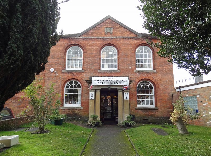
Early C19. (Tablet with dates 1827 and 1873). 2 storey symmetrical brick front.
Hipped tiled roof. Moulded cornice with toothed brick band. 3 windows 1st floor,
2 on ground floor, round headed recessed sasnes, glazing bars intact, gauged
brick arches. Central stone Doric porch the entrance flanked by pilasters and
columns, entablature with moulded cornice and blocking course.
Listing NGR: SU1895969113
External links are from the relevant listing authority and, where applicable, Wikidata. Wikidata IDs may be related buildings as well as this specific building. If you want to add or update a link, you will need to do so by editing the Wikidata entry.


Other nearby listed buildings
