Approximate Location Map
Large Map »
Latitude: 52.1738 / 52°10'25"N
Longitude: -2.1817 / 2°10'54"W
OS Eastings: 387672
OS Northings: 252850
OS Grid: SO876528
Mapcode National: GBR 1GD.M88
Mapcode Global: VH92V.4MHF
Plus Code: 9C4V5RF9+G8
Entry Name: Church Farmhouse
Listing Date: 3 August 1972
Grade: II
Source: Historic England
Source ID: 1273326
English Heritage Legacy ID: 445430
ID on this website: 101273326
Location: Wychavon, Worcestershire, WR5
County: Worcestershire
District: Wychavon
Civil Parish: Whittington
Traditional County: Worcestershire
Lieutenancy Area (Ceremonial County): Worcestershire
Church of England Parish: Worcester, St Martin with St Peter and Whittington
Church of England Diocese: Worcester
Tagged with: Farmhouse
WHITTINGTON WHITTINGTON
1.
2301
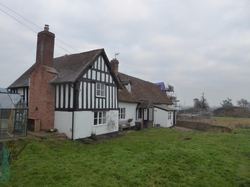
Church Farmhouse
SO 95 SE 4/869
II
2.
Long painted C18 brick building of l-storey and attic with Cl7 timber frame
cross wing with close set studding. Casements. Old tile roof.
Listing NGR: SO8767252850
External links are from the relevant listing authority and, where applicable, Wikidata. Wikidata IDs may be related buildings as well as this specific building. If you want to add or update a link, you will need to do so by editing the Wikidata entry.


Other nearby listed buildings
