Approximate Location Map
Large Map »
Latitude: 52.1768 / 52°10'36"N
Longitude: -2.1819 / 2°10'54"W
OS Eastings: 387655
OS Northings: 253185
OS Grid: SO876531
Mapcode National: GBR 1GD.F63
Mapcode Global: VH92V.4KC4
Plus Code: 9C4V5RG9+P6
Entry Name: Chapelry House
Listing Date: 3 August 1972
Grade: II
Source: Historic England
Source ID: 1273327
English Heritage Legacy ID: 445433
ID on this website: 101273327
Location: Swinesherd, Wychavon, Worcestershire, WR5
County: Worcestershire
District: Wychavon
Civil Parish: Whittington
Traditional County: Worcestershire
Lieutenancy Area (Ceremonial County): Worcestershire
Church of England Parish: Worcester, St Martin with St Peter and Whittington
Church of England Diocese: Worcester
Tagged with: House
WHITTINGTON WHITTINGTON
1.
2301
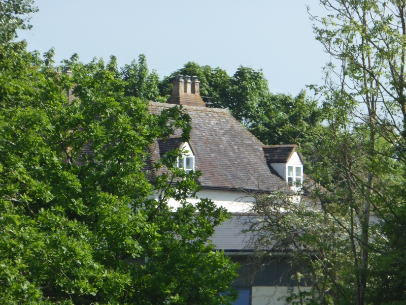
Chapelry House
SO 85 SE 4/872
II
2.
C18. Large regular house of square plan. 2-storeys and attics. Painted
brick. Casements and sashes. Hipped old tile roof. Brick bands at 1st
and 2nd floor levels.
Listing NGR: SO8765553185
External links are from the relevant listing authority and, where applicable, Wikidata. Wikidata IDs may be related buildings as well as this specific building. If you want to add or update a link, you will need to do so by editing the Wikidata entry.


Other nearby listed buildings
