Approximate Location Map
Large Map »
Latitude: 50.8657 / 50°51'56"N
Longitude: 0.026 / 0°1'33"E
OS Eastings: 542668
OS Northings: 109305
OS Grid: TQ426093
Mapcode National: GBR LRF.MDF
Mapcode Global: FRA B6YT.7YX
Plus Code: 9F22V28G+7C
Entry Name: Southerham Farmhouse
Listing Date: 27 September 1979
Grade: II
Source: Historic England
Source ID: 1273659
English Heritage Legacy ID: 417501
ID on this website: 101273659
Location: Lewes, East Sussex, BN8
County: East Sussex
District: Lewes
Civil Parish: Glynde
Traditional County: Sussex
Lieutenancy Area (Ceremonial County): East Sussex
Church of England Parish: Lewes St John the Baptist
Church of England Diocese: Chichester
Tagged with: Farmhouse
SOUTH MALLING WITHOUT
1.
5206
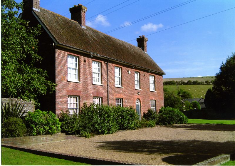
Southerham Farmhouse
TQ 40 NW 14/562
II
2.
C18. Two storeys. Five windows. Red brick and grey headers. Tiled roof.
Glazing bars intact.
Listing NGR: TQ4266809305
External links are from the relevant listing authority and, where applicable, Wikidata. Wikidata IDs may be related buildings as well as this specific building. If you want to add or update a link, you will need to do so by editing the Wikidata entry.


Other nearby listed buildings
