Approximate Location Map
Large Map »
Latitude: 51.3588 / 51°21'31"N
Longitude: 1.4427 / 1°26'33"E
OS Eastings: 639775
OS Northings: 167817
OS Grid: TR397678
Mapcode National: GBR X07.RKD
Mapcode Global: VHMCW.Y3KP
Plus Code: 9F339C5V+G3
Entry Name: 20, Albion Street
Listing Date: 20 September 1974
Grade: II
Source: Historic England
Source ID: 1273826
English Heritage Legacy ID: 415852
ID on this website: 101273826
Location: Broadstairs, Thanet, Kent, CT10
County: Kent
District: Thanet
Civil Parish: Broadstairs and St. Peters
Built-Up Area: Broadstairs
Traditional County: Kent
Lieutenancy Area (Ceremonial County): Kent
Tagged with: Building
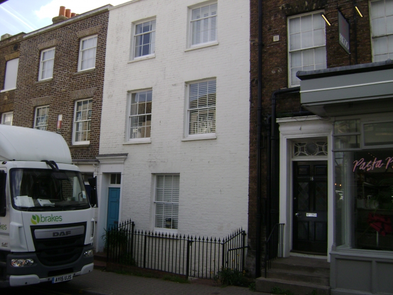
ALBION STREET
1.
5283
(South East Side)
BROADSTAIRS
No 20
TR 3967 NE 1/50
II GV
2.
Early C19. 3 storeys painted brick. Parapet with stone coping, 1 sash. Doorcase
to Albion Street elevation has a cornice, pilasters and rectangular fanlight.
Royal Albion Hotel, Nos 14 to 26 (even), Nos 30 & 32 form a group.
Listing NGR: TR3977567817
External links are from the relevant listing authority and, where applicable, Wikidata. Wikidata IDs may be related buildings as well as this specific building. If you want to add or update a link, you will need to do so by editing the Wikidata entry.


Other nearby listed buildings
