Approximate Location Map
Large Map »
Latitude: 50.708 / 50°42'28"N
Longitude: -1.5504 / 1°33'1"W
OS Eastings: 431845
OS Northings: 89911
OS Grid: SZ318899
Mapcode National: GBR 67B.JV0
Mapcode Global: FRA 77M6.RTF
Plus Code: 9C2WPC5X+5V
Entry Name: Hurst Lighthouse
Listing Date: 28 October 1974
Grade: II
Source: Historic England
Source ID: 1275169
English Heritage Legacy ID: 413119
Also known as: Hurst Point High Lighthouse
Hurst Point High Light
ID on this website: 101275169
Location: New Forest, Hampshire, SO41
County: Hampshire
District: New Forest
Civil Parish: Milford-on-sea
Traditional County: Hampshire
Lieutenancy Area (Ceremonial County): Isle of Wight
Church of England Parish: Milford-on-Sea All Saints
Church of England Diocese: Winchester
Tagged with: Lighthouse
1.
5235 KEYHAVEN
--------
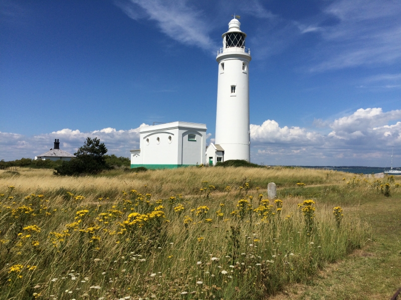
Hurst Lighthouse
SZ 38 NW 11/138
II
2.
1852. Circular building of 5 storeys with the light above. Stuccoed. Not occupied
and now works automatically.
Listing NGR: SZ3008192287
External links are from the relevant listing authority and, where applicable, Wikidata. Wikidata IDs may be related buildings as well as this specific building. If you want to add or update a link, you will need to do so by editing the Wikidata entry.


Other nearby listed buildings
