Approximate Location Map
Large Map »
Latitude: 54.8083 / 54°48'29"N
Longitude: -3.4304 / 3°25'49"W
OS Eastings: 308160
OS Northings: 546876
OS Grid: NY081468
Mapcode National: GBR 4DHV.34
Mapcode Global: WH6Z3.8DQQ
Plus Code: 9C6RRH59+8R
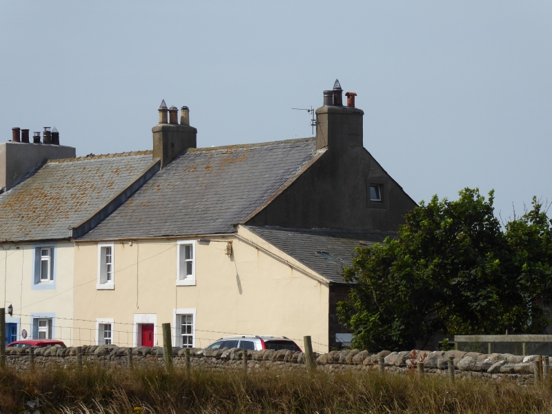
Entry Name: Ostle House
Listing Date: 13 August 1985
Grade: II
Source: Historic England
Source ID: 1275599
English Heritage Legacy ID: 411780
ID on this website: 101275599
Location: Mawbray, Cumberland, Cumbria, CA15
County: Cumbria
District: Allerdale
Civil Parish: Holme St Cuthbert
Traditional County: Cumberland
Lieutenancy Area (Ceremonial County): Cumbria
Church of England Parish: Holme Cultram St Cuthbert
Church of England Diocese: Carlisle
Tagged with: House
NY 04 NE HOLME ST CUTHBERT MAWBRAY
2/72 Ostle House
II
House. Dated and inscribed over entrance C & D.O. 1764 (Ostle). Painted
rendered walls, under Welsh slate roof with coped gables; rebuilt brick chimney
stack. 2 storeys, 2 bays. Panelled door in painted chamfered stone surround
under dated lintel. Sash windows, mostly with glazing bars. Stables adjoining
are not of interest.
Listing NGR: NY0816046876
External links are from the relevant listing authority and, where applicable, Wikidata. Wikidata IDs may be related buildings as well as this specific building. If you want to add or update a link, you will need to do so by editing the Wikidata entry.


Other nearby listed buildings
