Approximate Location Map
Large Map »
Latitude: 55.5776 / 55°34'39"N
Longitude: -1.6626 / 1°39'45"W
OS Eastings: 421369
OS Northings: 631606
OS Grid: NU213316
Mapcode National: GBR J3TY.VD
Mapcode Global: WHC0T.F2HF
Plus Code: 9C7WH8HP+3X
Entry Name: Old Pump to West of Number 132
Listing Date: 22 December 1969
Grade: II
Source: Historic England
Source ID: 1276106
English Heritage Legacy ID: 410377
ID on this website: 101276106
Location: North Sunderland, Northumberland, NE68
County: Northumberland
Civil Parish: North Sunderland
Built-Up Area: Seahouses
Traditional County: Northumberland
Lieutenancy Area (Ceremonial County): Northumberland
Church of England Parish: North Sunderland St Paul
Church of England Diocese: Newcastle
Tagged with: Architectural structure
NORTH SUNDERLAND MAIN STREET
NU 23 SW
(North side)
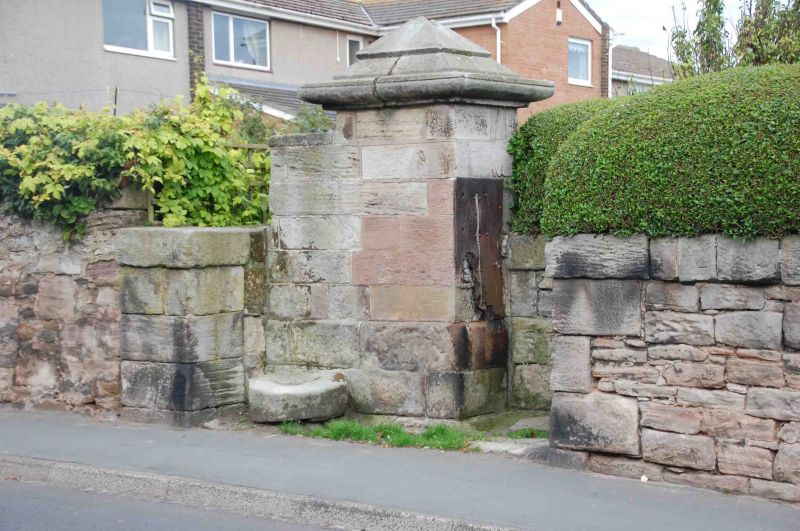
9/180 Old pump to west
of No 132
22.12.69
GV II
Pant or well. Early C19. Ashlar and iron. Square, corniced pier with
pyramidal cap. Iron plate for handle.
Listing NGR: NU2136931606
External links are from the relevant listing authority and, where applicable, Wikidata. Wikidata IDs may be related buildings as well as this specific building. If you want to add or update a link, you will need to do so by editing the Wikidata entry.


Other nearby listed buildings
