Approximate Location Map
Large Map »
Latitude: 51.018 / 51°1'4"N
Longitude: 0.469 / 0°28'8"E
OS Eastings: 573269
OS Northings: 127195
OS Grid: TQ732271
Mapcode National: GBR PV7.5CJ
Mapcode Global: FRA C6WF.6K0
Plus Code: 9F322F99+6H
Entry Name: 4, Station Road
Listing Date: 13 May 1987
Grade: II
Source: Historic England
Source ID: 1276239
English Heritage Legacy ID: 409988
ID on this website: 101276239
Location: Hurst Green, Rother, East Sussex, TN19
County: East Sussex
District: Rother
Civil Parish: Hurst Green
Built-Up Area: Hurst Green
Traditional County: Sussex
Lieutenancy Area (Ceremonial County): East Sussex
Church of England Parish: Salehurst St Mary
Church of England Diocese: Chichester
Tagged with: Building
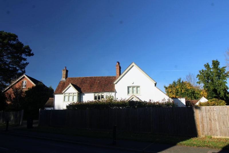
TQ 7227-7327 HURST GREEN STATION ROAD
(north side)
36/16 No 4
II
Early C19. Two storeys. Two windows. Faced with weather-boarding. Tiled
roof. Casement windows. C19 gabled addition of one window bay to north east.
C19 addition behind.
Listing NGR: TQ7326927195
External links are from the relevant listing authority and, where applicable, Wikidata. Wikidata IDs may be related buildings as well as this specific building. If you want to add or update a link, you will need to do so by editing the Wikidata entry.


Other nearby listed buildings
