Approximate Location Map
Large Map »
Latitude: 52.4476 / 52°26'51"N
Longitude: -2.2279 / 2°13'40"W
OS Eastings: 384609
OS Northings: 283314
OS Grid: SO846833
Mapcode National: GBR 1C1.FLC
Mapcode Global: VH91G.BRK1
Plus Code: 9C4VCQXC+2V
Entry Name: K6 Telephone Kiosk
Listing Date: 10 November 1989
Grade: II
Source: Historic England
Source ID: 1277066
English Heritage Legacy ID: 407894
ID on this website: 101277066
Location: Dunsley, South Staffordshire, DY7
County: Staffordshire
District: South Staffordshire
Civil Parish: Kinver
Built-Up Area: Kinver
Traditional County: Staffordshire
Lieutenancy Area (Ceremonial County): Staffordshire
Church of England Parish: Kinver St Peter
Church of England Diocese: Lichfield
Tagged with: K6 telephone box
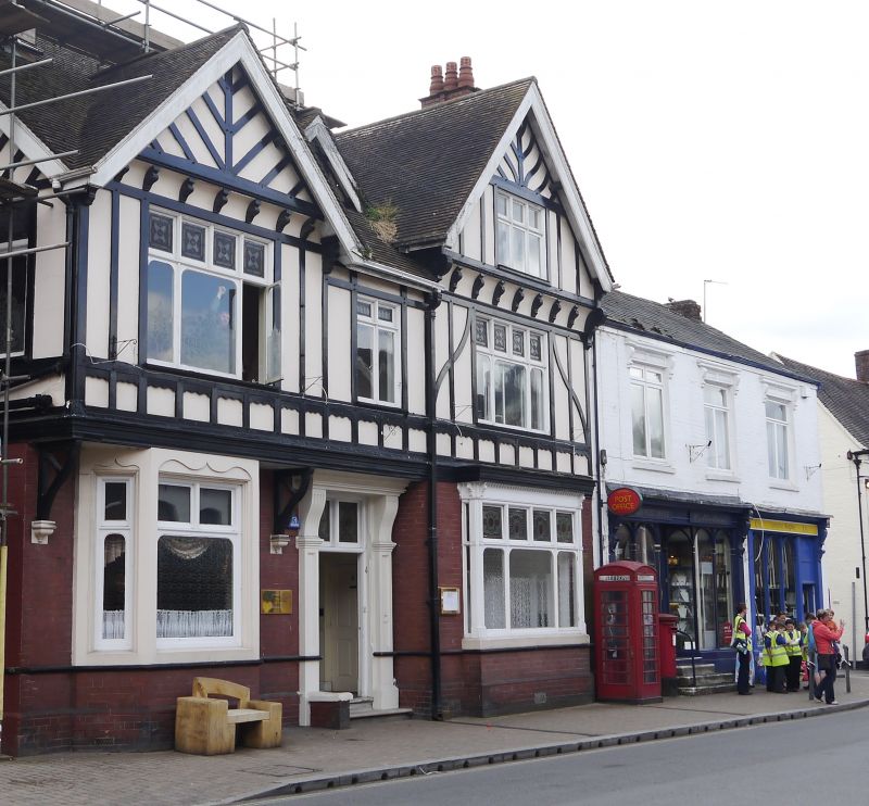
KINVER HIGH STREET
SO 8483-8583
15/108 K6 Telephone Kiosk
GV II
Telephone kiosk. Type K6. Designed 1935 by Sir Giles Gilbert Scott. Made by
various contractors. Cast iron. Square kiosk with domed roof. Unperforated
crowns to top panels and margin glazing to windows and door.
Listing NGR: SO8460983314
External links are from the relevant listing authority and, where applicable, Wikidata. Wikidata IDs may be related buildings as well as this specific building. If you want to add or update a link, you will need to do so by editing the Wikidata entry.


Other nearby listed buildings
