Approximate Location Map
Large Map »
Latitude: 52.9568 / 52°57'24"N
Longitude: 0.8521 / 0°51'7"E
OS Eastings: 591675
OS Northings: 343740
OS Grid: TF916437
Mapcode National: GBR R5T.L7X
Mapcode Global: WHLQK.2Y04
Plus Code: 9F42XV42+PR
Entry Name: Malthouse
Listing Date: 13 June 1972
Grade: II
Source: Historic England
Source ID: 1277438
English Heritage Legacy ID: 406921
ID on this website: 101277438
Location: Wells-next-the-Sea, North Norfolk, NR23
County: Norfolk
District: North Norfolk
Civil Parish: Wells-next-the-Sea
Built-Up Area: Wells-next-the-Sea
Traditional County: Norfolk
Lieutenancy Area (Ceremonial County): Norfolk
Church of England Parish: Wells-next-the-Sea St Nicholas
Church of England Diocese: Norwich
Tagged with: Malt house
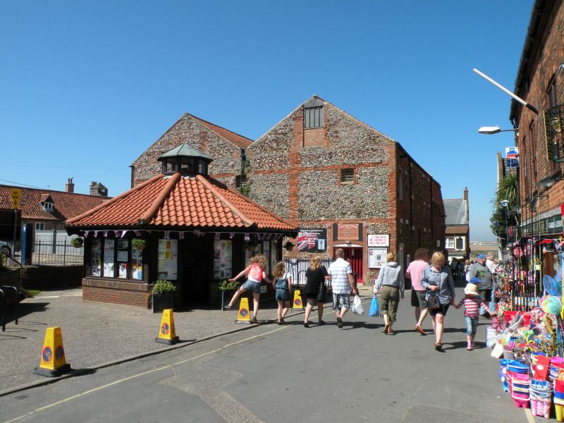
TF 9143 615/2/132
STAITHE STREET (West Side)
No.12
Malthouse
II
Early C19, former maltings later granary, Quaternary flint and chert south front with brick flush bands and quoins with twin gables. Red brick, east, four storeys, ten window range of rather small iron barred openings with segmental heads.
Listing NGR: TF9167543740
External links are from the relevant listing authority and, where applicable, Wikidata. Wikidata IDs may be related buildings as well as this specific building. If you want to add or update a link, you will need to do so by editing the Wikidata entry.


Other nearby listed buildings
