Approximate Location Map
Large Map »
Latitude: 53.6167 / 53°37'0"N
Longitude: -1.9082 / 1°54'29"W
OS Eastings: 406172
OS Northings: 413359
OS Grid: SE061133
Mapcode National: GBR HV3M.P7
Mapcode Global: WHB91.NCK5
Plus Code: 9C5WJ38R+MP
Entry Name: 9, Booth Bank
Listing Date: 11 July 1985
Grade: II
Source: Historic England
Source ID: 1278202
English Heritage Legacy ID: 406333
ID on this website: 101278202
Location: Booth Bank, Kirklees, West Yorkshire, HD7
County: Kirklees
Electoral Ward/Division: Colne Valley
Parish: Non Civil Parish
Traditional County: Yorkshire
Lieutenancy Area (Ceremonial County): West Yorkshire
Church of England Parish: Slaithwaite with East Scammonden St James
Church of England Diocese: Leeds
Tagged with: Building
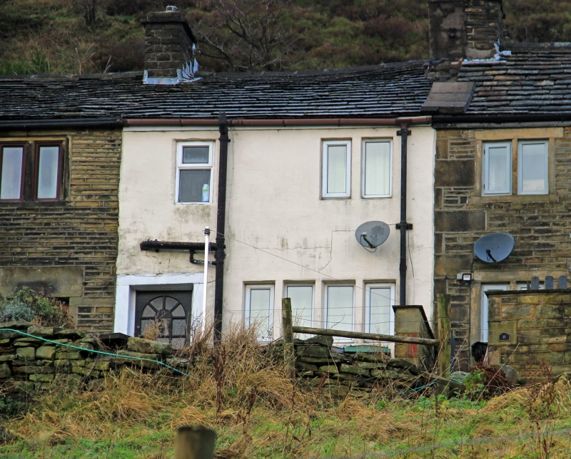
SE 0613 BOOTH BANK
Slaithwaite
12/44
No 9
-
GV II
Late C18/early C19. House, part of row. Rendered walls. Pitched stone slate
roof (bitumenised). Two storeys. South East elevation: Ground floor: one
4-light stone mullioned window. Entrance to left. First floor: one 2-light
stone mullioned window. Modern casement in stone surround.
Listing NGR: SE0617213359
External links are from the relevant listing authority and, where applicable, Wikidata. Wikidata IDs may be related buildings as well as this specific building. If you want to add or update a link, you will need to do so by editing the Wikidata entry.


Other nearby listed buildings
