Approximate Location Map
Large Map »
Latitude: 52.6331 / 52°37'59"N
Longitude: 1.2926 / 1°17'33"E
OS Eastings: 622904
OS Northings: 309019
OS Grid: TG229090
Mapcode National: GBR W8V.PW
Mapcode Global: WHMTM.T2PQ
Plus Code: 9F43J7MV+62
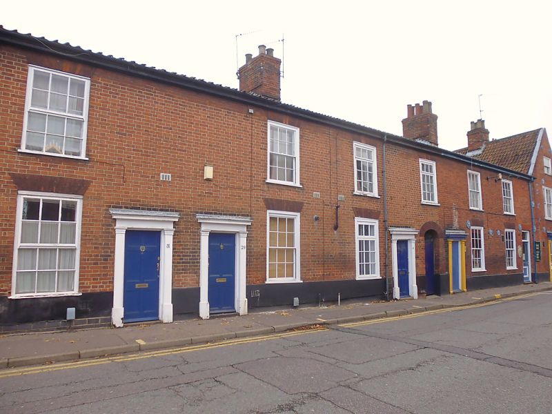
Entry Name: 25-31, Duke Street
Listing Date: 5 March 1982
Grade: II
Source: Historic England
Source ID: 1280184
English Heritage Legacy ID: 229024
ID on this website: 101280184
Location: Coslany, Norwich, Norfolk, NR3
County: Norfolk
District: Norwich
Electoral Ward/Division: Mancroft
Parish: Non Civil Parish
Built-Up Area: Norwich
Traditional County: Norfolk
Lieutenancy Area (Ceremonial County): Norfolk
Church of England Parish: Norwich St George, Colegate
Church of England Diocese: Norwich
Tagged with: Building
TG 2209 SE DUKE STREET
(east side)
10/273
5.3.82 Nos. 25 to 31 (odd)
GV II
Former terraced houses now brewery. Early C19. Red brick. Pantile roof.
Each house:- 2 storeys. Single bay. Side door with simple pilasters,
architrave and hood. C20 casements with rubbed brick flat arches.
Box cornice.
Listing NGR: TG2290409019
External links are from the relevant listing authority and, where applicable, Wikidata. Wikidata IDs may be related buildings as well as this specific building. If you want to add or update a link, you will need to do so by editing the Wikidata entry.


Other nearby listed buildings
