Approximate Location Map
Large Map »
Latitude: 50.3532 / 50°21'11"N
Longitude: -4.4537 / 4°27'13"W
OS Eastings: 225539
OS Northings: 53241
OS Grid: SX255532
Mapcode National: GBR NG.W1TY
Mapcode Global: FRA 18K3.GQB
Plus Code: 9C2Q9G3W+7G
Entry Name: Clifford Cottage
Listing Date: 17 September 1973
Grade: II
Source: Historic England
Source ID: 1280664
English Heritage Legacy ID: 376419
ID on this website: 101280664
Location: Looe, Cornwall, PL13
County: Cornwall
Civil Parish: Looe
Built-Up Area: Looe
Traditional County: Cornwall
Lieutenancy Area (Ceremonial County): Cornwall
Church of England Parish: St Martin with St Nicholas, Looe
Church of England Diocese: Truro
Tagged with: Cottage
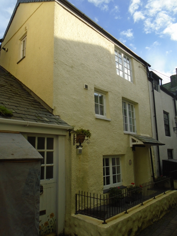
LOOE
SX2453 LOWER MARKET STREET, East Looe
857-1/4/36 (North East side)
17/09/73 Clifford Cottage
GV II
Town house. C18. Render on rubble; steep asbestos slate roof.
Double-depth plan. 3 storeys; irregular 2-window (1st floor)
range. C20 windows and door under C20 hood. INTERIOR not
inspected.
Listing NGR: SX2553953241
External links are from the relevant listing authority and, where applicable, Wikidata. Wikidata IDs may be related buildings as well as this specific building. If you want to add or update a link, you will need to do so by editing the Wikidata entry.


Other nearby listed buildings
