Approximate Location Map
Large Map »
Latitude: 52.3656 / 52°21'56"N
Longitude: -2.7202 / 2°43'12"W
OS Eastings: 351057
OS Northings: 274414
OS Grid: SO510744
Mapcode National: GBR BK.S50G
Mapcode Global: VH843.SSTX
Plus Code: 9C4V978H+6W
Entry Name: 18, Mill Street
Listing Date: 15 April 1954
Grade: II
Source: Historic England
Source ID: 1281986
English Heritage Legacy ID: 390026
ID on this website: 101281986
Location: Ludlow, Shropshire, SY8
County: Shropshire
Civil Parish: Ludlow
Built-Up Area: Ludlow
Traditional County: Shropshire
Lieutenancy Area (Ceremonial County): Shropshire
Church of England Parish: Ludlow St Laurence
Church of England Diocese: Hereford
Tagged with: Building
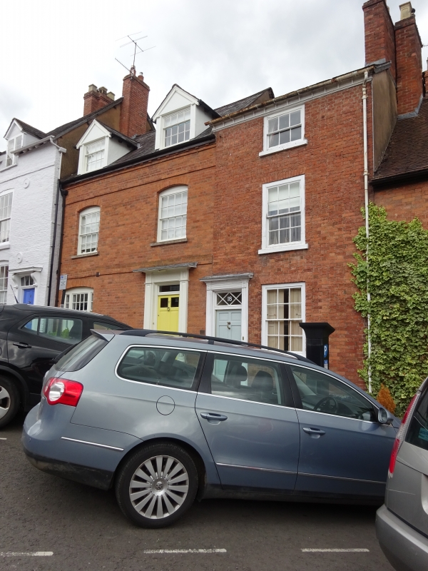
LUDLOW
SO5174 MILL STREET
825-1/1/391 (East side)
15/04/54 No.18
GV II
House. Late C18. Brick; Welsh slate roof; brick end stack.
3-storeys and cellar; single-window range: C20, 6/6 sash in
broad beaded case under flat arch; 3/3 sash over; moulded wood
eaves. Entrance to left: 6-panel door and overlight with
glazing bars in plain doorcase, under moulded flat hood on
moulded pilasters.
Listing NGR: SO5106074416
External links are from the relevant listing authority and, where applicable, Wikidata. Wikidata IDs may be related buildings as well as this specific building. If you want to add or update a link, you will need to do so by editing the Wikidata entry.


Other nearby listed buildings
