Approximate Location Map
Large Map »
Latitude: 51.4619 / 51°27'42"N
Longitude: -1.7144 / 1°42'51"W
OS Eastings: 419940
OS Northings: 173698
OS Grid: SU199736
Mapcode National: GBR 4WP.CCH
Mapcode Global: VHC1H.7JJ4
Plus Code: 9C3WF76P+Q7
Entry Name: Milestone by Access to Hallam Farm Buildings
Listing Date: 2 September 1986
Grade: II
Source: Historic England
Source ID: 1284490
English Heritage Legacy ID: 311336
ID on this website: 101284490
Location: Southend, Wiltshire, SN8
County: Wiltshire
Civil Parish: Ogbourne St. George
Traditional County: Wiltshire
Lieutenancy Area (Ceremonial County): Wiltshire
Tagged with: Milestone
SU 17 SE OGBOURNE ST GEORGE A345
(west side)
7/84 Milestone by access to
Hallam Farm buildings
II
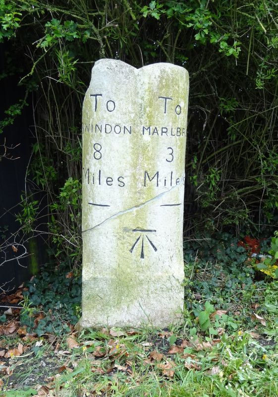
Milestone on second Swindon Marlborough turnpike. Early C19.
Shaft of chord of cylinder section, with grooved top. Legend
reading, on left: TO SWINDON / 8. On right: TO / MARLBORO' / 3.
The second road, on the east bank of the Og, was turnpiked in 1819.
Listing NGR: SU1994073698
External links are from the relevant listing authority and, where applicable, Wikidata. Wikidata IDs may be related buildings as well as this specific building. If you want to add or update a link, you will need to do so by editing the Wikidata entry.


Other nearby listed buildings
