Approximate Location Map
Large Map »
Latitude: 51.6211 / 51°37'15"N
Longitude: -1.077 / 1°4'37"W
OS Eastings: 463994
OS Northings: 191763
OS Grid: SU639917
Mapcode National: GBR B27.BJ1
Mapcode Global: VHCYJ.8JZ4
Plus Code: 9C3WJWCF+C5
Entry Name: Brownings
Listing Date: 18 July 1963
Grade: II
Source: Historic England
Source ID: 1285686
English Heritage Legacy ID: 247810
ID on this website: 101285686
Location: Ewelme, South Oxfordshire, OX10
County: Oxfordshire
District: South Oxfordshire
Civil Parish: Ewelme
Built-Up Area: Benson
Traditional County: Oxfordshire
Lieutenancy Area (Ceremonial County): Oxfordshire
Church of England Parish: Ewelme
Church of England Diocese: Oxford
Tagged with: Building
SU69SW
2/101
18/07/63
EWELME
HIGH STREET
(South side)
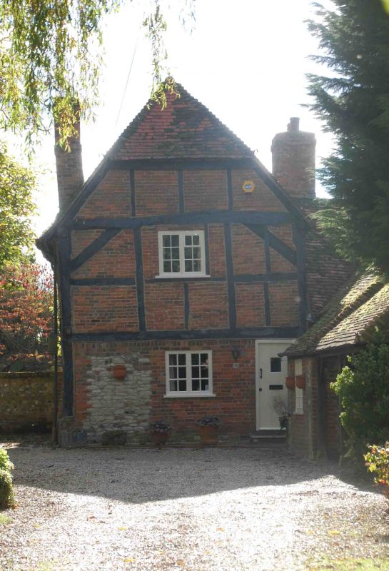
Brownings
II
House. C17. Red brick to ground floor; timber framing with brick infill to first
floor; old plain-tile roof; brick internal stack to left. 2 storey,
single-window range. C20 panel door to right. 2-light: casement to ground and
first floor. Half-hipped cross-gable to roof. Interior not inspected.
Listing NGR: SU6398491763
External links are from the relevant listing authority and, where applicable, Wikidata. Wikidata IDs may be related buildings as well as this specific building. If you want to add or update a link, you will need to do so by editing the Wikidata entry.


Other nearby listed buildings
