Approximate Location Map
Large Map »
Latitude: 53.593 / 53°35'34"N
Longitude: -2.6713 / 2°40'16"W
OS Eastings: 355665
OS Northings: 410925
OS Grid: SD556109
Mapcode National: GBR 9VSW.GQ
Mapcode Global: WH86D.YY4D
Plus Code: 9C5VH8VH+6F
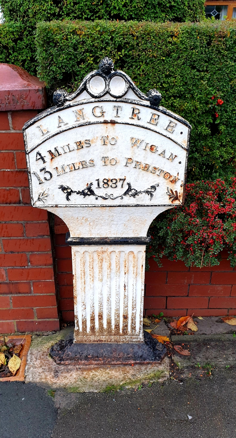
Entry Name: Milepost Outside Number 247
Listing Date: 10 May 1988
Grade: II
Source: Historic England
Source ID: 1287162
English Heritage Legacy ID: 403072
ID on this website: 101287162
Location: Standish, Wigan, Greater Manchester, WN6
County: Wigan
Electoral Ward/Division: Standish with Langtree
Parish: Non Civil Parish
Built-Up Area: Standish
Traditional County: Lancashire
Lieutenancy Area (Ceremonial County): Greater Manchester
Church of England Parish: Standish St Wilfrid
Church of England Diocese: Blackburn
Tagged with: Milestone
STANDISH-WITH-LANGTREE PRESTON ROAD
SD 51 SE
(east side)
2/124 Milepost outside
- No. 247
- II
Milepost. Dated 1837. Cast iron. Short fluted flat post
supports segmental-headed rectangular plate with decorative
cresting. Lettering reads:" LANGTREE/4 MILES TO WIGAN//23
MILES TO PRESTON/(1837)".
Listing NGR: SD5566510924
External links are from the relevant listing authority and, where applicable, Wikidata. Wikidata IDs may be related buildings as well as this specific building. If you want to add or update a link, you will need to do so by editing the Wikidata entry.


Other nearby listed buildings
