Approximate Location Map
Large Map »
Latitude: 50.7318 / 50°43'54"N
Longitude: -2.7609 / 2°45'39"W
OS Eastings: 346394
OS Northings: 92735
OS Grid: SY463927
Mapcode National: GBR PP.0J8S
Mapcode Global: FRA 5734.N7K
Plus Code: 9C2VP6JQ+PJ
Entry Name: Priory Cottage
Listing Date: 19 September 1975
Grade: II
Source: Historic England
Source ID: 1287501
English Heritage Legacy ID: 402224
ID on this website: 101287501
Location: Bridport, Dorset, DT6
County: Dorset
Civil Parish: Bridport
Built-Up Area: Bridport
Traditional County: Dorset
Lieutenancy Area (Ceremonial County): Dorset
Church of England Parish: Bridport St Mary
Church of England Diocese: Salisbury
Tagged with: Cottage
1/
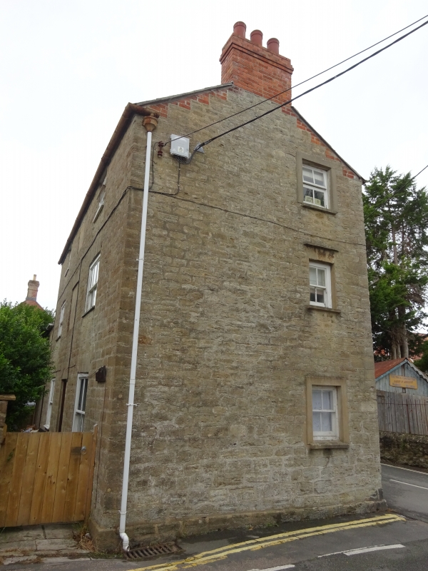
5191 ST MICHAEL'S LANE
(West Side)
No 72 (Priory Cottage)
SY 4692 3/401
II GV
2.
Early or mid C19. Hammer dressed stone. Pitched slate roof. 3 storey.
2 ranges of sashes in moulded frame.
No 72 (Priory Cottages) forms a group with all the listed buildings in Priory Lane.
Listing NGR: SY4639492735
External links are from the relevant listing authority and, where applicable, Wikidata. Wikidata IDs may be related buildings as well as this specific building. If you want to add or update a link, you will need to do so by editing the Wikidata entry.


Other nearby listed buildings
